 Tbilisi - Lying on the banks of the Kura (Mtkvari) River, amid the foothills of the Trialeti mountain range, Tbilisi is Georgia's capital and largest city with a population of roughly 1.5 million inhabitants (more than a third of the nation's citizens). Historically, due to its location at the crossroads of trade, culture and religion, it has long been a site of contention between imperial powers. Since its founding in the mid 5th century (by Vakhtang I of Iberia), the city has seen periods under Persian, Arab, Turkish, Mongol, and Russian influence. Each have left their indelible mark. As such, modern-day Tbilisi has its own unique and eclectic vibe - one of East meets West - evident in its food, its art, its language, and its neighborhoods. Tbilisi - Lying on the banks of the Kura (Mtkvari) River, amid the foothills of the Trialeti mountain range, Tbilisi is Georgia's capital and largest city with a population of roughly 1.5 million inhabitants (more than a third of the nation's citizens). Historically, due to its location at the crossroads of trade, culture and religion, it has long been a site of contention between imperial powers. Since its founding in the mid 5th century (by Vakhtang I of Iberia), the city has seen periods under Persian, Arab, Turkish, Mongol, and Russian influence. Each have left their indelible mark. As such, modern-day Tbilisi has its own unique and eclectic vibe - one of East meets West - evident in its food, its art, its language, and its neighborhoods.
Visit our Tbilisi travel itinerary.
Maps: pop-up map, Google, Bing, Yandex
Websites: Tbilisi City Hall (official website), Tbilisi (Wikipedia)
|
Historical Monuments of Mtskheta (Georgia) - Just 24 km (15 miles) northwest of Tbilisi, at the confluence of the Aragvi and Mtkvari Rivers, lies Mtskheta - one of the most historic cities in Georgia. Capital of the early Georgian Kingdom of Iberia (from the 3rd century BC to the 5th century AD), it is home to a number of important cultural monuments, and was designated a UNESCO World Heritage Site in 1994. The Historical Monuments of Mtskheta consist of the Samtavro Monastery, the Svetitstkhoveli Cathedral, and the Jvari Monastery.
Maps: pop-up map, Google, Bing, Yandex
Websites: UNESCO, Wikipedia
- Samtavro Monastery - photo - Built (presumably) in the 4th century by the King Mirian III, and reconstructed in the 11th century by the King George I, the complex once served as the residence of the lords of Mtskheta (Georgian translation of Samtavro is “ruler's place”). Since the second half of the 19th century, the southwest buildings of the monastery have functioned as both a nunnery and theological seminary of the Georgian Orthodox Church.
- Samtavro Church - photo - The main church of the monastery, built in the early 11th century. Its construction is characteristic of the cross-dome style of the era. The church's facades are richly decorated, particularly that of the southern side.
- St. Nino's Church - photo - Small church dating back to the 4th century.
- Bell-Tower - photo - Situated in the northwest corner, the three-story tower was built in the 16th century. The ground floor incorporates an entrance to the monastery, the second floor served as both a living quarters and observation point, and the third floor is an open belfry.
- Tombs of Mirian and Nana - photo - Mirian III and his wife Queen Nana are buried in its southwest corner of the monastery grounds. The canopy and gravestones were made in the 19th century.
- Svetitstkhoveli Cathedral - photo - Situated in the center of town, the cross-dome style cathedral was originally constructed between 1010 and 1029, although remnants of the foundation of a 5th century church were discovered during one of its numerous renovations. The cathedral holds distinction as the second largest church in Georgia (after the Holy Trinity Cathedral), the burial place of Georgian kings, and the purported home of Christ's robe.
One of the more interesting stories surrounding Svetitstkhoveli Cathedral is that of its interior walls. Once fully adorned with medieval frescos, they were whitewashed prior to the visit of Russian Emperor Nicholas I. (They wanted to give the cathedral a “tidier look”.) To add insult to injury, the Czar was a no-show. Nevertheless, after careful restoration, some of the frescos have been preserved.
Svetitstkhoveli Cathedral is surrounded by a defensive wall (built in 1787). It has eight towers - six cylindrical and two square. In addition, archaeological expeditions have found the 11th century house of the Patriarch at the southern part of the wall, while remnants of the two-story palace of Anton II (Patriarch from 1788 to 1811) are also found within the church yard.
- Jvari Monastery - photo - Perched atop a rocky hilltop overlooking Mtskheta (just across the Aragvi River to the east of the town), is one of the most treasured monuments of Early Medieval Christian architecture. Built between 586 and 605 by Iberian Prince Stephen I, Jvari Church is one of the earliest examples of a four-apsed church with four niches (essentially a cross-shaped design with four shells coming together). So innovative in design for its day, that this style is often considered the “Jvari-style” of church architecture. *This claim of being the “first” is still open to debate, since Armenian and Georgian churches developed the same style of architecture around the same period.
While the interior was once painted in frescos, most are weathered beyond recognition. Under the dome near the center of the interior stands an ancient stone pedestal with a wooden cross. The pedestal was originally the base for the sacred cross of Saint Nino, which purportedly stood atop the hill since the early 4th century (predating the cathedral), from the time when King Mirian III converted to Christianity. *Saint Nino's cross is now housed at the Tbilisi Sioni Cathedral. Various stone-carved bas-relief sculptures decorate portions of the southern and eastern facades, with a particularly detailed depiction of the Ascension of the Cross above the southern entrance.
In the late Middle Ages the monastery was fortified by a stone wall, remnants of which still survive. The gated entrance was from the east.
|
Stepantsminda - Situated just 12 km (7.5 miles) south of the Russian border and 150 km (93 miles) north of Tbilisi (along the Georgian Military Highway), is a charming little town tucked in a scenic valley of the Greater Caucasus Mountains. Officially named Stepantsminda (but still commonly known as by its old name of Kazbegi), the idyllic community has become a popular ecotourism destination in recent years. Outdoor enthusiasts come to explore the area's many backcountry attractions including Mount Kazbegi (Georgia's third-highest peak) and the expansive Kazbegi Nature Reserve.
Maps: pop-up map, Google, Bing, Yandex
Website: Wikipedia
Just a few of Stepantsminda's outdoor opportunities include...
- Gergeti Glacier hike - photo - Check out the itinerary for a day hike at nomadflag.com, which will take you from the town-site (or Gergeti Trinity Church) to the glacier.
- Juta Valley trekking - photo - hiking, camping and climbing opportunities starting from Juta village, going to the base of Mount Chaukhebi - roughly 5 km (3 miles) on foot. *Juta village can be reached from Stepantsminda via a bumpy 16 km (10 mile) 4x4 drive up the Dzhuta Valley.
- Mount Kazbegi (Mount Kazbek) - photo - climbing tours for the 5,054 m (16,581 ft) mountain.
- mountain biking
- horse-back riding
In combination with exploring the natural wonders of Stepantsminda, visitors have the opportunity to discover the area's cultural and historical riches as well.
- Gergeti Trinity Church (Tsminda Sameba Church) - photo - Perched on an isolated hilltop high above the town of Stepantsminda, the medieval church is a visually stunning landmark with the majestic Mount Kazbegi in the background. Built in the 14th century, the crossed-domed church, as well as an adjacent bell-tower dating from the same period, once acted as a sanctuary for religious treasures from Mtskheta during times of invasion. Today the venerated structure is a favorite day hike, taking approximately 1.5 hours on foot from the town of Stepantsminda. *Since late 2018 a winding 6 km (3.7 mile) stretch of paved road was laid, taking cars and tour buses from town, up to the base of the church.
Map: Google
Websites: Wikipedia, Wander-Lush.org (detailed post about hike to Gergeti Trinity Church)
Stepantsminda has a growing number of guest houses, hotels and restaurants to accommodate its increasing popularity. Stepping off their bus or mashrutka (mini-bus) arriving in town, visitors will often find enterprising hosts offering affordable homestay options that include room and board. Alternatives to homestays include everything from a budget hostels, to five-star hotels with luxury amenities. |
Gori - Situated in the central part of Georgia, 86 km (53 miles) northeast of Tbilisi and just south of the de facto state of South Ossetia, is the nation's fashion capital and birthplace of notorious Soviet leader Joseph Stalin. The name “Gori” is derived from the Georgian word “hill”, thanks to settlements and fortifications built on the city's hilltop since the early Bronze Age onward.
Maps: pop-up map, Google, Bing, Yandex
Website: Wikipedia
The fortress as well as other area landmarks are as follows...
- Gori Fortress (Goristsikhe) - photo - The citadel acquired its present-day form in the 17th and 18th centuries, although archaeological evidence shows that the area had already been fortified several centuries before Christ. The fortress first appears in historical records when 13th century Georgian chronicles mention that Gori was founded by King David IV (1089-1125). Since that time the fortress was sacked and/or occupied by numerous foreign powers including Alan tribesmen (from the Northern Caucasus), Persians, Ottomans, and Russians.
- Historical Ethnographic Museum - photo - Museum housing cultural and historical exhibits, including ancient archaeological artifacts, weapons, national costumes and textiles, traditional jewelry, and furniture.
- Joseph Stalin Museum - photo - One of the main tourist attractions in Gori (and principal revenue earners), the Stalin Museum is situated in the city's central square. Opened in 1957 (Stalin died in 1953), the museum has retained many of its Soviet-era qualities - thanks in part to locals who have been steadfast in preserving its oddly nostalgic portrayal of one of the 20th century's most infamous figures. All together, the Stalin Museum is comprised of three parts...
- Exhibition Building - photo - Suitably built in the Stalinist style of architecture, the exhibition is divided chronologically into separate halls that detail the Soviet leader's life - from his adolescence, right through his reign as the General Secretary. Archives include everything from office furniture and personal effects, to official documents, photographs and newspaper articles. The exhibition concludes with a somewhat creepy death mask - one of twelve that were molded shortly after his passing.
- Stalin Memorial House - photo - A small wooden home where Stalin was born (in 1878) and spent his first four years of his life. Stalin's father Vissarion Jughashvili (a local shoemaker), rented the room on the left-hand side of the building and maintained a workshop in the basement, while the landlord lived in the right-hand room.
- Stalin's Railway Carriage - photo - A personal railway coach (Stalin hated to fly), that was fitted with armor plating and an elegant interior. Stalin used the railway carriage from 1941 onwards, including trips to attend the 1943 Tehran Conference and 1945 Yalta Conference.
- Great Patriotic War Museum - photo - Museum housing a collection of photographs and memorabilia such as medals, equipment, and personal effects from the region's participants. A section about the 2008 invasion has also been added. *The city was occupied by Russian troops during the 2008 Russo-Georgian War.
- Gori Historical Ethnographic Museum - photo - Situated in the city center just west of Stalin Park, the museum houses a small but broad collection of historical and cultural exhibits ranging from the 4th century BC, right up until the 20th century. Artifacts include ancient stone carvings, paintings, pottery, manuscripts, photo archives, tools, weapons, furniture, numismatics, jewelry, textiles, national costumes, and more. Its interesting to note that while the Gori Historical Ethnographic Museum focuses on Georgia's broader national history and culture, many of the artifacts actually originated from the local Shida Kartli region, which in itself, is home to a wealth of ancient and medieval archaeological sites. *Guided museum tours in are available in English and Russian for a very reasonable price.
Map: Google
- Gorijvari (St. George's Church) - photo - Situated high on a hilltop overlooking Gori, the church's name literally means “Gori Cross”. It was originally built in the 12th century, but a demolition by the Turks and devastation left in the wake of a 1920 earthquake, resulted in a fairly new iteration built in the 1980s. In spite of its age, the church still holds a special place for residents of Gori. On days commemorating St. George (November 23 and April 23), Gori residents congregate at the church in accordance with Orthodox tradition. Hiking to and from Gorijvari takes roughly 1.5 hours each way. To reach the trailhead...
- walk south along Stalin Avenue until you cross the river
- the road will cut to the right, then cross the railroad tracks
- on the other side of the tracks turn right
- then take the first left
- then at 26 Ketskhoveli Street take the windy path up the hill that is immediately on your right
- the windy path twists up the hill until you find a graveyard on your left
- from the graveyard, stay right
Map: Google
- Uplistsikhe - photo - Roughly 10 km (6.2 miles) east of Gori is an ancient cave city carved from the surrounding rock. It contains various structures dating from the Early Iron Age to the Late Middle Ages, making it one of the oldest urban settlements in Georgia.
The name “Uplistsikhe” literally means “the Lord's fortress”. It was an important religious and political center during the pre-Christian Iberian Empire, before losing importance to new centers of Christianity in Mtskheta, and later in Tbilisi. It once again reemerged as a principal Georgian stronghold during the Muslim conquest of Tbilisi in the 8th to 10th centuries, before declining for good following the Mongol invasions of the 14th century.
The Uplistsikhe complex can be divided into three parts: south (lower), middle (central) and north (upper), covering an area of approximately 8 hectares (20 acres). It has been on the tentative list for inclusion into the UNESCO World Heritage program since 2007.
- Ateni Sioni Church - photo - Situated in the village of Ateni, roughly 10 km (6.2 miles) south of Gori, is a splendid 7th century Georgian Orthodox church. Tucked in an idyllic setting amongst the steep banks of the Ateni Gorge and vineyards of the Tana River Valley, the domed tetraconch (four-apsed) church was modeled on the Jvari Church (at Mtskheta) that predates it. Ateni Sioni Church has detailed bas-relief sculptures that decorate the exterior walls, and is particularly famed for its 11th century frescoes. The harmonious interior composition depicting biblical scenes and Georgian rulers, are possibly the best-preserved medieval frescoes in Georgia.
|
Batumi - Located in western Georgia on the Black Sea coast, Batumi is the nation's second largest city and capital of the Autonomous Republic of Adjara. Thanks to its beautiful backdrop squished between the Caucasus Mountains and the sea, as well as its pleasant subtropical climate, the historical sea port - known as “Bathus” (deep harbor) by the ancient Greeks - has seen a growing reliance on tourism in recent years. Now amongst its charming 19th century architecture, new multi-storey hotels, casinos and apartments blocks are springing up to meet the city's growing popularity. During the tourist season - from May until September - visitors from Europe and around the world fly in to enjoy the city's beaches, vibrant nightlife, gambling, pristine mountains, and amazing Georgian food and wine.
Maps: pop-up map, Google, Bing, Yandex
Websites: Batumi City Hall (official website), Batumi.com (official tourism portal), Wikipedia
- Seaside Park (Batumi Boulevard) - photo - Established in 1881 by well-known Prussian gardener designers Ressler and Reier, the seaside promenade has been extended over the years, and now stretches roughly 7 km (4.3 miles) down the Black Sea coastline. Batumi Boulevard is a multi-purpose leisure and recreational space with a myriad of attractions for all ages. There are paths the entire length for walking, jogging and biking. Access to the beach for swimming and sunbathing. Children's playgrounds, an aqua-park, and giant Ferris wheel. Skateboarding, football and volleyball facilities. A tennis facility that accommodates competitive tournaments. An area for chess and backgammon enthusiasts. Dancing fountains, sculptures, landscaped lawns, and park benches throughout the park. An open-air concert venue. Lots of local cafes, restaurants and clubs. And much, much more.
Map: Google
Website: Batumi Boulevard (official website)
- 6th of May Park - photo - Sharing a common border with Seaside Park (separated by Rustaveli Avenue), the park was also established in 1881 by garden designers Ressler and Reier. Briefly named “Alexander's Garden” (in honor of Czar Alexander III, who visited and planted several Magnolia trees), 6th of May Park currently consists of the following...
- Colonnade - photo - Similar to the colonnade in Seaside Park, the Greek style colonnade was added to the entrance of the park in the 1930s. After World War II, a statue of Georgia's first female pilot - Fadiko Gogitidze - was added in the center of the colonnade. Fadiko Gogitidze died heroically in the war at the age of 24 years old.
- Nurigeli Lake - photo - A small oval-shaped lake in the center of the park, with a surface area of 5.5 hectares (13.6 acres) - or just a little bigger than a football field. The lake is named according to the legend of a baby boy named Nuri, who fell into the lake and drowned. The baby’s mother used to visit the lake everyday and call out to her baby, “Nuri geli” (Nuri I am waiting for you). Row boats can be rented for leisurely paddle around the lake.
- Batumi City Zoo - photo - Established in the 1930s, the zoo underwent significant renovations in 2006. Here you will find various species of hoofed animals, marsupials, primates, and birds. There is also a petting zoo where children can interact with the animals.
- Batumi Dolphinarium - photo - Opened in 1975, it was the first dolphinarium opened in the Soviet Union. The 700 seat facility underwent upgrades in 2011, including new pools, water filtration and temperature systems. The performers include a group of Bottlenose Dolphins and several California Sea Lions.
- Batumi Aquarium - photo - Opened in 1966, the aquarium contains around 100 species of fish from the Black Sea, Georgian rivers and lakes ,as well as exotic species.
- Batumi Piazza - photo - Situated near the Seaside Park, about 4 blocks from the Black Sea, is a popular, contemporary Italian-style square. Surrounded by three boutique hotels, several restaurants, a pub and a cafe, the piazza is distinguished for its 106 m² (1,141 ft²) circular mosaic, considered to be one of the largest figurative marble mosaics in Europe (consisting of no less than 8,244,735 cut and treated tiles). While more European than Georgian in style, Batumi Piazza's lovely surrounding architecture, detailed mosaic terrace and frequent live music, create a rather pleasant atmosphere to sit, relax, wine and dine - particularly under the lights in the evenings.
Map: Google
Website: Wikipedia
- Batumi Archaeological Museum - photo - Opened to the public in 1994 (though it has a much longer history serving as a center for archaeological research), the museum's collection is currently housed in a two-storey building on Chavchavadze Street. Organized in chronological order right from the Stone Age to the Middle Ages, the museum exhibits archaeological finds excavated from Pichvnari (a Colchian - pre-Hellenistic - settlement north of Batumi), Khelvachauri (district south of Batumi that includes Gonio Fortress), and other sites across the Adjara region. Just a few artifacts in the Batumi Archaeological Museum's collection include: ancient pottery and glassware, Greek-era signet rings, Roman statues, gold and bronze plates of different historical periods, coins, crosses, and relief images from medieval orthodox temples. Along with the museum's intuitive layout, exhibits are well labeled in English, Georgian and Russian, giving visitors a clear and enlightening overview of the Adjara region's rich history and culture.
Map: Google
- Batumi Bazaar (Agricultural Market) - photo - For a tiny nation, Georgia has a worldwide reputation for delicious food and wine. The secret - fresh ingredients, still unspoiled by factory farming found in many developed nations. For this reason its a treat to visit the local Batumi Bazaar. Here you can find an assortment of fresh local fruits, vegetables, dairy, meat, spices, wine, and homemade goodies. And be prepared to interact with the friendly vendors eager to let you sample, then sell you their products.
Map: Google
- Argo Cable Car - photo - Spanning a length of almost 2.6 km (1.6 miles) and climbing a height of 256 meters (840 ft), Batumi's cable car links the city's waterfront to the Argo Entertainment Center (restaurant-shopping complex) on Anuria Mountain. The operation runs 20 eight-seat gondolas that take approximately 10-15 minutes to cover a one-way trip - which means at full capacity it can move upwards of 500 passengers per hour.
A trip on the Argo Cable Car is well worth the small fare. The viewing platform from the Argo Entertainment complex offers spectacular panoramic views of Batumi, the Black Sea and surrounding mountains. (Nighttime views of Batumi are equally beautiful). Floating above streets and buildings also gives passengers a unique bird's-eye perspective of the city below. And if you choose a clear day, savor the panorama at the top and stop for a drink or a snack at the restaurant. It may be a little more pricey than the restaurants below, but just remember, you're paying for the view.
Maps: pop-up map, Google
- Batumi Botanical Garden - photo - Situated 9 km (5.6 miles) north of Batumi in an area known locally as “Mtsvane Kontskhi” (the Green Cape), the garden was officially opened in 1912 under the guidance of Russian botanist Andrey Krasnov (his grave and statue are still located on the garden grounds). During the Soviet era it was further expanded to its current area of 109 hectares (269 acres), making it one of the largest botanical gardens in the former Soviet Union. Today, Batumi Botanical Garden is comprised of nine phyto-geographical departments: Transcaucasian humid subtropics, East Asian, North American, New Zealand, South American, Himalayan, Mexican, Australian, and Mediterranean.
Set high on a green slope with gorgeous views overlooking the Black Sea, a trip to Batumi Botanical Garden can (easily) take a half day. Although there's a lot of walking, the canopied trails remain pleasantly cool, even in the hot summer days. And for those who are unable to walk for long distances, rides on an electric cart are available (for a small fee). The electric cart covers the whole park in roughly 30 minutes.
*Recommended itinerary for getting to Batumi Botanical Garden then back to Batumi... take Yandex.Taxi to the top entrance of the garden (10 to 15 minute drive from Batumi), stroll down to the bottom, then take Bus No. 10 back to the city.
Map: Google
Website: Batumi Botanical Garden (official website), Wikipedia
|
Gonio Fortress - Situated 12 km (7.5 miles) south of Batumi on the southern embankment of the Chorokhi River, is one of the oldest settlements in Georgia - dating back to the Roman Empire in the 1st century AD. Previously known as “Apsaros” in Ancient Greek (thus often referred to as the “Gonio-Apsaros Fortress”), the citadel occupies a total area of 4.4 hectares (11 acres). It originally had walls that were 5 meters (16.4 ft) in height, twenty-two towers that were 7 meters (23 ft) in height, and four gates. Today only eighteen towers and the western gate have survived.
The Gonio-Apsaros Fortress served a strategic role for the Romans, as a stronghold at the eastern boundaries of their empire. As a result it grew in economic and cultural importance, confirmed by archaeological ruins of a Roman theater and a hippodrome. Another claim to fame of the 1st century Roman fortress, is the purported burial site of Saint Matthias (one of the twelve apostles, chosen to replace Judas Iscariot after Judas betrayed Jesus).
Transitioning from the Roman Empire, Gonio Fortress subsequently came under Byzantine influence, then was a short-lived Genoese trade center, then came under Ottoman control in 1547. The Ottoman Turks held it until 1878, when the region of Adjara became part of the Russian Empire.
Based on the important historical and cultural significance of the Gonio Fortress, the Georgian government declared it museum-reserve in 1994. The site of past (and ongoing) archaeological excavations, it has turned up a multitude of artifacts from the various periods in its history. Some of these artifacts are displayed at the Batumi Archaeological Museum and other historical museums throughout Georgia. Others are housed on-site at the small archaeological museum found within the Gonio-Apsaros Fortress reserve.
Maps: pop-up map, Google, Bing, Yandex
Websites: Wikipedia |
Makhuntseti Waterfall & Tamar Bridge - Situated 33 km (20.5 miles) east of Batumi in the Keda municipality (of the Adjara region), are several neighboring sites that can be combined for a pleasant day-trip outside of the city. Getting there is fairly easy. If you don't want to hire a taxi, you can take any minibus from Batumi that goes to the towns of Keda, Shuakhevi and/or Khulo. Just let the driver know you'll be getting off at Makhuntseti and keep an eye out for the distinctive stone bridge.
Maps: pop-up map, Google (Makhuntseti Waterfall), Google (Tamar Bridge)
- Makhuntseti Waterfall - photo - Considered one of the most beautiful waterfalls in Georgia, the 36 meter (118 ft) high Makhuntseti Waterfall (also known as Queen Tamar Waterfall), is set in a picturesque lush, rocky backdrop. There is parking right at the waterfall, but even if you walk between the bridge and the falls, its no more than a half kilometer. And you'll be rewarded with the cool mist and rejuvenating air from the falls.
- Queen Tamar Bridge - photo - A late 12th century stone arch bridge built under the auspices of Georgia's first female ruler - Tamar the Great (reigned from 1184 to 1213). Also called Makhuntseti Bridge, it spans a distance of over 20 meters (66 ft) across the Adjaristskali River, making it one of the largest arch bridges in the Adjara region. Its really quite amazing that a bridge built so many years ago is still a functioning foot bridge (makes for a great photo op).
- Swimming hole & rafting - photo - If you are visiting during the warm summer months, be sure to take a bathing suit if you'd like to take a dip in the Adjaristskali River swimming hole (where there is a sandy beach near the historical bridge), or take a raft ride down a 6 km (3.7 mile) stretch of the river.
- Picnic or café - photo - After working up an appetite, you can either find a pleasant spot for a picnic, or visit the terraced restaurant by the river. For a low price you'll be treated to Georgian cuisine that includes fresh trout (caught locally), as well as Keda wine from the family winery (Chkhaveri Rose and Tsolikauri White) and Chacha (grape vodka) from an oak barrel. Also in the vicinity, visitors will find vendors selling fresh fruit, berries, jams, local honey, and Churchkhela (candle-shaped candy made with grape must, nuts, and flour).
|
Zugdidi - Situated 322 km (200 miles) northwest of Tbilisi - only about 29 km (18 miles) from the Black Sea coast - is the capital of the Samegrelo-Zemo Svaneti region. This western Georgian region combines the historical provinces of Samegrelo (Mingrelia) and Upper Svaneti. While things to see and do in Zugdidi are limited, it serves as an good base for exploring sites of Samegrelo, as well as Upper Svaneti (one of the most remote mountain regions of Georgia). *For clarity, we've separated Upper Svaneti into its own section (see below).
Maps: pop-up map, Google, Bing, Yandex
Websites: City of Zugdidi (official website), Wikipedia
Some of the attractions of Samergrelo (in and around the city of Zugdidi), include...
- Dadiani Palace Museum - photo - Situated at the former palace estate of the final ruling dynasty of Samegrelo (Principality of Mingrelia), the overall complex consists of the palace of Ekaterine Chavchavadze-Dadiani (the last queen of Samegrelo), the former residence of her son (Niko Dadiani), a monastery, and what is now the Zugdidi Botanical Garden (see below).
The queen's palace was built in the early 19th century and attained neo-Gothic style elements when it underwent renovations in the 1860s. It currently showcases the family's personal art and belongings, as well as a collection of historical artifacts started by Prince David Dadiani in 1848. Exhibits ranging from the Bronze Age to the late 19th century include: archaeological excavations from Nokalakevi (see below), ancient coins, weapons, handwritten manuscripts, and more. One notable piece in the collection is a shroud (only shown on church holidays), purportedly that of the Virgin Mary, taken from Byzantium to Western Georgia by the ancestors of Dadiani princes in the 15th century. Other interesting items are those associated with Napoleon Bonaparte - including one of only three of Napoleon's death masks. *One of the Dadiani princesses was married to Askil Murat, Napoleon's nephew, and thus inherited various relics from the former Emperor.
Map: Google
- Zugdidi Botanical Garden - photo - Located on the former palace estate is a 26.4 hectare (65 acre) botanical garden established in 1840 by Prince David Dadiani for his wife Queen Ekaterine. He had it designed by eminent European gardeners of the time and ordered rare plants from abroad - including the gardens of Versailles. Although it was severely damaged by Ottoman invaders in 1856 (during the Crimean War), Queen Ekaterine managed to revive the garden to its original beauty. Today the Zugdidi Botanical Garden is home to a great variety of domestic plants, as well as exotic species introduced from southeast Asia, India, Japan, the Mediterranean and the Americas. The garden is branch of Tbilisi Central Botanical Garden (link) and is administered by the Georgian Academy of Sciences.
Map: Google
- Zugdidi Bazaar (Produce Market) - photo - Situated between the train station and the center of town, Zugdidi's produce market is a fun way to spend an hour, shopping for fresh fruits, vegetables, dairy, meat, spices, wine, and homemade treats.
Map: Google
- Rukhi Fortress - photo - Situated at the periphery of Rukhi village, roughly 7 km (4.5 miles) north of Zugdidi, is a castle that dates back to 1647. Built by Prince of Samegrelo (Principality of Mingrelia), Levan II Dadiani, the castle sits in a strategic location near the southeastern bank of the Patara Enguri River. The fortress has an inner courtyard surrounded by two towers and walls approximately 10-12 meters (33-39 ft) in height. It was the site of several battles with Turkish forces, including a 1672 invasion by the Ottomans (described in detail by French traveler Jean Chardin).
Just across the bridge, on the opposite side of the Patara Enguri River, is the de facto state of Abkhazia. From atop the walls, visitors can get a great view of the surrounding area, including the Abkhazian landscape across the river.
Map: Google
- Chakvinji Fortress - photo - Located approximately 13 km (8 miles) to the east of Zugdidi, high on a hill overlooking the village of Jihaskari, is the medieval castle of Chakvinji. Originally built during the period of the Kingdom of Abkhazia in the 8th century AD, the fortress saw reconstructions in the 12th century, and 16th to 17th centuries. It served as a summer palace of Samegrelo (the Principality of Mingrelia), and was the birthplace of Prince David Dadiani in 1813. In the early 20th century, during the struggle to establish Soviet power in Georgia, it was the site of armed conflict, and as a result damage incurred, as well as centuries of disrepair, Chakvinji Fortress awaits much needed attention and restoration. Regardless, if you enjoy historic fortifications, its still worthy of a day trip from Zugdidi. Its fun to explore and the views from the walls are spectacular.
Map: Google
- Enguri Dam - photo - An easy day trip 37 km (23 miles) north of Zugdidi (or 10 km north of the town of Jvari), the impressive concrete engineering wonder is Georgia's version of the Hoover Dam. Located on the Enguri River that flows from the Caucasus Mountains, construction of the Enguri dam began in 1961, it became operational in 1978, and was fully completed by 1987. Standing 271.5 meters (891 ft) high, and spanning a length of 680 meters (2,231 ft), it was the world's tallest arch damn until three taller Chinese dams were completed between 2010 and 2013.
While the arch dam itself is located within the Georgian controlled territory of Upper Svanetia, the power station is actually located within the de facto state of Abkhazia. Such a joint operation between the two otherwise feuding sides, helps foster peace and cooperation around a common interest.
Enguri Dam currently operates at a power capacity of roughly 1,320 megawatts, supplying Georgia (roughly 40% of then nation's electricity needs) and Abkhazia, plus allowing the sale of surplus capacity to neighboring Russia and Turkey.
Enguri Dam has been added to Georgia's list of most distinguished cultural heritage sites, with plans to develop a tourist infrastructure (visitor center, museum, observation points) in coming years.
Map: Google
- Tsaishi Cathedral - photo - Situated in the village of Tsaishi, just 10 km (6.2 miles) southwest of Zugdidi, is the home to one of the oldest episcopal chairs in Georgia. *The Bishopric of Tsaisha dates back to the late 6th, early 7th centuries. The domed church itself was built between the 13th and 14th centuries, and underwent significant restorations after a devastating earthquake in 1614. In the late 18th to early 19th centuries, a bell-tower and surrounding wall were added to the grounds.
In 1823 the Russian government abolished the Bishopric of Tsaisha (along with other bishoprics), and the cathedral transitioned to a teaching monastery. It remained a monastery up to the latter part of the 19th century. Upon the arrival of the Bolsheviks, the religious site was closed and abandoned. Tsaishi Cathedral was only restored to a practicing Georgian Orthodox church in 1989.
Map: Google
- Martvili Canyon - photo - Located roughly 64 km (40 miles) east of Zugdidi (still in the the Samegrelo-Zemo Svaneti region of western Georgia), is one of the nation's beautiful natural wonders. Once a bathing spot for the Dadiani family - the ruling dynasty of Samegrelo (the Principality of Mingrelia) - Martvili Canyon is an emerald green river flowing through high furrowed cliffs with a dense cluster of moss-clad trees spilling over the top. Formed by the waters of the Abasha (Abashi) River, it stretches 2.4 km (1.5 miles), with the height of the canyon walls reaching 40 m (131 ft) in places.
In 2016 improvements were made to the canyon's tourist infrastructure, including a tourist center, walking paths (with several bridges and viewing platforms), plus a facility for inflatable boat tours through a portion of the canyon. While the paddle through Martvili Canyon is relatively short (lasting only 10 to 20 minutes), it makes for some great photo opportunities - including that of a 12 meter waterfall.
Martvili Canyon makes for a good day trip from Zugdidi (about 1.5 hours by car), but for those who'd like to stay the night, there are assorted guest houses sprinkled in the area - from right near the canyon, to the town of Martvili 5 km (3 miles) to the south.
Map: Google
|
Upper Svaneti - Part of the Samegrelo-Zemo Svaneti region, which is administered from the city of Zugdidi (see above), Upper Svaneti is a unique area unto itself. Its a remote landscape dominated by towering mountains and deep gorges, one inhabited by an ethnic subgroup of Georgians known as Svans. Due to the remoteness of the region, the Svans have retained much of their traditional culture and traditions, and still speak their own - Svan language (an endangered language that falls into the South Caucasian - or Kartvelian - language family).
Of equal significance to the unique culture and splendid landscapes, are the alpine region's well-preserved architectural treasures. Thanks to the area's long isolation, Upper Svaneti has managed to retain its authentic medieval-type villages that include distinctive “Svan towers” (tower-houses), earning the region a coveted distinction as a UNESCO World Heritage Site.
- Mestia - photo - Situated 128 km (80 miles) northeast of Zugdidi, at an elevation of 1,500 meters (4,921 ft) above sea level, Mestia is the regional center of Upper Svaneti. A highland destination popular for cultural tourism, backcountry trekking and mountaineering, it is essentially a conglomeration of three villages following the Mulkhra River (Lekhtagi to the northwest, Lanchvali and Lagami to the northeast), with a single main street connecting each hamlet. Known for its distinctive “Svan towers” that are set against the striking backdrop of the Greater Caucasus Mountains, Mestia has seen an onset of tourism development in recent years, with the construction of new hotels, a renovated town center (including a central square or “Setis moedani”), a small regional airport, and two new ski resorts.
Maps: pop-up map, Google, Bing, Yandex
Website: Wikipedia
- Svan Towers - photo - The symbol of Mestia and the Svanetia region, the three to five storey defensive towers were generally built along with complimentary stone dwellings that included an adjacent house (machubi) and various other household structures. Each fortified dwelling served as a living space for people and livestock, protection from natural disasters such as an avalanche, and as a sanctuary during conflict. Upon enemy invasion, a flame would be lit at the top of the tower. As soon as the flame was noticed, neighboring towers would do the same. And soon the entire region would take refuge and be ready for war.
- Svaneti Museum of History and Ethnography - photo - A must-see museum that illustrates the history and culture of the local Svan people. Founded in 1936, the museum showcases a wide variety of artifacts including: iron, silver and copper ornaments, jewelry, medieval weaponry, pottery, traditional textiles, icons, engravings, manuscripts (including one of the oldest New Testament manuscripts in Georgia), and more. Artifacts are exhibited in modern display cases and have written descriptions in English.
- Hiking & Trekking - photo - Mestia is great base for world class hiking and trekking. The area offers a variety of trails that vary in length and difficulty. And one of the best things about hiking and trekking in the Mestia region, is that local villages are situated relatively close to one another, allowing for “guesthouse trekking”. You can spend up to a week on the trail without the need to sleep in a tent (if you don't want to). One of the best resources for hiking and trekking itineraries in the Mestia region, is Caucasus-Trekking.com. Follow theses links for: the best day hikes around Mestia, or a more extensive list that includes multi-day treks.
- Skiing - photo - Two new ski resorts - Hatsvali and Tetnuldi - are helping Mestia become a year-round outdoor destination. While their development is a work in progress, they have the potential to become reputable establishments in the years to come.
- Hatsvali - photo - lies at the edge of Mestia and offers beginner and intermediate ski runs. The upper part of the lift - at the top of Zuruldi Ridge - sits at an elevation of 2,350 meters (7,710 ft).
- Tetnuldi - photo - the newer of the two ski hills (opened in 2016), lies on the slopes of Tetnuldi Mountain, roughly 15 km (9 miles) from Mestia. It caters to more advanced skiers and those who enjoy skiing and snowboarding on ungroomed terrain. The upper part of the lift sits at an elevation of 3,165 meters (10,384 ft).
- Ushguli - photo - One of the highest continuously inhabited settlements in Asia Minor, at an altitude of 2,100 metes (6,890 ft), Ushguli is a community of four villages located in the Enguri River gorge, near the foot of Shkhara Mountain (one of the highest summits of the Greater Caucasus mountain range). The four villages include Murqmeli, Chashashi, Chvibiani and Shibiani, which lie along the Enguri River for a distance of roughly two kilometers. Thanks to its remote location that is snow covered nearly half of the year, and a road from Mestia that is at times impassible, Ushguli still maintains many of its traditional village characteristics. And though its more overrun with tourists of late, most visitors only come on a day trip from Mestia (arriving around 11am and leaving at 3pm in order to get home before dark). Therefore, if you choose to stay for a night or two, you'll be treated to Ushguli's gorgeous mornings and evenings - minus the crowds - and some of the area's splendid hikes.
The road running from Mestia to Ushguli is roughly 46.5 km (29 miles). Private taxis in Mestia can be hired for a reasonable price. OR, a bus (marshrutka) leaves Mestia near the stone archway on the Main Street at 10am. The bus returns from Ushguli at 2pm from the Cafe-Bar Enguri parking lot.
Maps: pop-up map, Google, Bing, Yandex
Website: Wikipedia
- Svan Towers - photo - Over 40 Svan defensive towers can be found in Ushguli. The oldest Svan Towers date back to the 8th and 9th centuries, while the youngest are just over 200 years old. Though free-standing towers exist, most of the three to five storey Svan Towers were built in conjunction with an adjacent house (machubi) and various other household structures. Each fortified dwelling served as a living space for people and livestock, protection from natural disasters such as an avalanche, and as a sanctuary during conflict and invasion.
- Ushguli Ethnographic Museum - photo - Situated in the upper part of Ushguli (village of Shibiani), in a well preserved Svan house from the 16th century, the small museum contains artifacts from Upper Svaneti's long history. A good place to kill some time if the weather outside is uncooperative, visitors can gain a better picture of life in the region through exhibits of locally made furniture, arts and crafts, tools, weapons, religious icons, and more.
- Lamaria Church (Ushguli Church of the Mother of God) - photo - Situated on a hill in the upper (northeast) end of Ushguli, is a small church built in the 9th or 10th century. The ancient and still functional church is purported by the locals to be the burial place of Tamar of Georgia (Queen of Georgia from 1184 to 1213). The dimly lit inside of Lamaria Church is adorned with 13th century frescos that are faded but still discernible. Every year on August 28th, people gather here to celebrate St. Mary's Day.
Map: Google
Website: Wikipedia
- Hiking & Trekking - photo - Due to the high altitude, which gives rise to roughly six months of snowy terrain, the best time for a trekking in Ushguli is the heart of the summer (conditions in spring and late fall can be unpredictable). Like hikes in Mestia, there are a variety of trails to choose from that vary in difficulty based on distance and elevation. Perhaps the most popular trail in Ushguli is the day hike to Shkhara Glacier. The 16 km (10 mile) hike starting at Lamaria Church, takes trekkers up to the source of the renowned Enguri River. To learn more about this and other hikes in the area, visit Caucasus-Trekking.com's Best Hikes in Ushgui.
|
Nokalakevi Fortress - Situated in the Senaki municipality of the Samegrelo-Zemo Svaneti region - roughly halfway between Zugdidi to the northwest and Kutaisi to the east (about one hour's drive from either city), is an archaeological site with origins as far back as the 8th century BC. Believed by some scholars to be the ancient Colchian capital from the Greek Argonaut myth (the quest for the Golden Fleece), the site was known to Byzantines as Archaeopolis (“ancient town”), and to Georgians as Tsikhegoji (“Fortress of Kuji”). Therefore it goes by any of these names - Nokalakevi, Archaeopolis, or Tsikhegoji.
Built on the bank of the Tekhuri River, Nokalakevi-Archaeopolis took advantage of the site's position within a loop of the river, with steep and rugged terrain to the north making the fortification almost unassailable. In addition, a wall connected the fortified citadel to a “lower town” below.
The most prevalent archaeological remains on the 19 hectare (47 acre) museum-conservation area date back to the late Roman period (4th to 6th century AD), when the site was a key fortresses guarding Lazika (Mingrelian vassal of Byzantium) against invasion from Iberia and the Sasanian Empire to the east. Various ruins from this era include: the remnants of two towers, two baths, a water reservoir, a 4th century Royal Palace, and a 5th century basilica. There is also an impressively engineered tunnel leading from the fortress grounds, down to the river.
Ongoing excavations continue to uncover archaeological treasures from various layers of the fortress's history, many of which are exhibited in the archaeological museum located on the reserve's grounds.
Maps: Google, Bing, Yandex
Website: Wikipedia |
Kolkheti National Park - Located in western Georgia, with its visitor center on the southern outskirts of Poti, is a 337 km² (130 mile²) park created to protect the Kolkheti wetland ecosystem. Lying on the coastal alluvial plain of the Black Sea, Kolkheti National Park incorporates extensive peat wetlands and lakes, including Lake Paliastomi - which has a surface area of 17.3 km² (6.7 mile²). The site supports a wealth of flora and fauna species, including 194 species of birds (21 species that use the wetlands during seasonal migration). Nominated for the UNESCO World Heritage List (Colchis Wetlands and Forests), the “Wetlands of Central Kolkheti” have also been designated as a wetlands of international importance by the Ramsar Convention (an international treaty for the conservation of wetlands for waterfowl habitat).
Because of the terrain, Kolkheti doesn't have walking trails like a typical national park. Rather, visitors are able to see the natural environment via boat rides and kayaks (which should be booked ahead of schedule - see contact info). A trip on the “Georgian Amazon” includes a two hour ride on Paliastomi Lake and Pichori River with a driver/guide, plus a rest-stop on one of the shores for a picnic.
*To get there from Poti city center, take minibus (marshrutka) number 20 that goes to Maltakva, and ask the driver to drop you off at the visitor's center of Kolkheti National Park.
Maps: pop-up map, Google, Bing, Yandex
Websites: Kolkheti National Park (National Parks of Georgia), Wikipedia |
Ananuri - Situated on the bank of Aragvi River near Zhinvali Reservoir, roughly 66 km (41 miles) north of Tbilisi, is one of the best-preserved castles in Georgia. Dating from the 17th century, the complex was the seat of the Eristavis (Dukes) of Aragvi, a feudal dynasty that ruled the area from the 13th century. Highlights of Ananuri include: a castle wall with turrets, a large square tower known as Sheupovari, a round tower, a tall square tower with a stepped pyramidal roof, the small single-nave Mkurnali Church that dates to the mid-16th century, plus the larger cupola Church of the Assumption of the Mother of God (1689) with its richly decorated facades and remnants of interior frescos that survived an 18th century fire. Ananuri also has a spring and a reservoir, and below the fortress is an old road and bridge that have survived regular floods.
The site of numerous battles, it was here in 1739 where the Duchy of Aragvi was attacked by forces from the rival Duchy of Ksani. The invading forces destroyed the underground water supply, leaving the besieged people inside the castle with no potable water. Promised their lives if they surrendered, the Aragvi clan turned itself in, only to be set ablaze in one of the towers. Legend has it that the Eristavis of Ksani were thereafter cursed for perjury.
Ananuri fortress remained in use until it fell out of favor in the beginning of the 19th century. In 2007, it was put on the tentative list for inclusion as a UNESCO World Heritage Site.
Maps: pop-up map, Google, Bing, Yandex
Website: Wikipedia |
David Gareja Monastery Complex - Situated in the Kakheti region roughly 69 km (43 miles) southeast of Tbilisi, lies a medieval monastic complex that intersects a disputed border area between Georgia and Azerbaijan (though the majority of the complex falls on the Georgian side). An important site of religious and cultural heritage, the complex includes churches, a refectory, defensive walls, and a myriad of cells (chapels, tombs, living quarters, animal dwellings and storage sheds) carved into the rugged, semi-dessert slopes of Mount Garejait. Founded in the 6th century by David Garejeli (one of the thirteen Assyrian monks), it was from here that Saint David and his disciples worked to strengthen Christianity in the region. Reaching a zenith of activity between the 11th and 13th centuries, and despite devastation and decline at the hands of the Mongol army in 1265, and further destruction by Safavid Persians in 1615 (when monks were massacred and the monastery's unique manuscripts and works of art were destroyed), the complex remained a living, working monastery right up until the early 20th century.
Some of the cave structures have their interiors covered with well-preserved murals and fresco paintings depicting scenes from the life of St. David, as well as representations of Georgian kings and politicians of the medieval period. And since part of the monastery complex is technically located within Azerbaijan, a hike up the mountain next to the monastery will give visitors views of the Azerbaijani border.
To get to the David Gareja Monastery Complex, look for a direct bus from Freedom Square in Tbilisi departing at 11am, or take a marshrutka (mini-bus) to the the nearest village - Udabno. If you're going during the summer, take plenty of water and sunscreen (temperatures can get rather hot), plus proper footwear, a packed lunch and your own ration of toilet paper (tourist facilities are limited). And since its a border area, make sure to have your passport or a proper ID since there's an off chance of being stopped by border patrol.
Maps: pop-up map, Google, Bing, Yandex
Website: Wikipedia |
Kutaisi - Situated 222 km (138 miles) northwest of Tbilisi, on the banks of the the Rioni River, is Georgia's third largest city and capital of the Imereti region. Historically a seat of power, it served as the pre-Hellenistic capital of Colchis, the capital of Lazica for a period during the the Roman/Byzantine period, the capital of the united Kingdom of Georgia (from 1008 to 1122), and the capital of the Kingdom of Imereti (from the mid-15th century until 1810). Today, the tranquil city of Kutaisi serves as a relaxing alternative to faster-paced cities of Tbilisi and Batumi, as well as an excellent base to explore the region's abundant cultural and natural attractions.
Maps: pop-up map, Google, Bing, Yandex
Websites: City of Kutaisi (official website), Wikipedia
Just a few of the regional attractions include...
- Kutaisi's hidden charms - photo - A stroll through the lovely streets and avenues of Kutaisi is a pleasant way to unwind from a busy travel itinerary. Follow the tree-lined streets that meander down to the banks of the Rioni River and side streets that lead to low-key little restaurants serving local Imeretian cuisine, quiet parks and vibrant markets.
- Kutaisi Street Art - photo - Explore Kutaisi's varried streets and courtyards and discover colorful murals, street art, sculptures and hip little cafes.
- Central Green Bazaar - photo - An authentic local market in the heart of Kutaisi selling everything from fruits, vegetables and spices, to meats, cheese, transitional sweets and local wine, to clothes and household wares. Friendly vendors and an vast array of colors, tastes and fragrances.
Map: Google Map
- Jewish Quarter - photo – Kutaisi has a number of historic synagogues, testifying to the long history of the Georgian Jewish community. The town’s most recognized synagogue, the Kutaisi Synagogue located on the Gaponov Street 57–59, was built in 1885. Other historic synagogues are located at Gaponov Street 8 and Gaponov Street 10.
Map: Google Map
- Colchis Fountain - photo - Situated in the middle a large round about in the city center, the centerpiece of the fountain is a pair of golden horses, with terraces below decorated with animal figures. All the figures are said to be enlarged replicas of actual unearthed jewelry dating back to the era of ancient Colchis.
Map: Google Map
- City Parks - One of the best ways to get a taste of the city's vibe is to visit one of the many parks scattered throughout the regional capital. With tall trees that shelter park benches and walking paths below, the parks are a popular meeting place for locals of all ages, particularly on warm summer afternoons and evenings.
- Kutaisi Park - photo - A large treed park in the city center, its a pleasant place to stroll in the afternoon, or simply sit and observe the locals as they come out to socialize in the evenings.
Map: Google Map - Youth (Pioneer) Park - photo - Situated just off of Ilia Chavchavadze Ave, the Fir tree covered park is a great place to go for a walk, a bike ride, or even a picnic. In the summer, the park also hosts a traveling circus.
Map: Google Map
- Rioni River Embankment - photo - A natural, picturesque area running through Kutaisi with tree-lined rocky banks that are crossed by numerous bridges (including the Chain Bridge and Tetri Bridge). There are plenty of spots to stroll and relax, further adding to the city's tranquil ambiance.
- Besik Gabashvili Amusement Park - photo - A worthwhile visit regardless if you are traveling with children or not, the park is accessible from the city center (look up and you'll notice notice a Ferris wheel poking through the trees on the hill across the Rioni River). Consisting of some outdated amusement rides, a Georgian restaurant serving traditional Imeretian dishes, and a rather lovely view of the city, perhaps the best part of Besik Gabashvili Amusement Park is getting there. While alternate ways of accessing the park are available (on foot or by taxi), be sure to take the old yellow cable car - a five minute aerial tramway that zips you from the city center, up over Rioni River, to the park above. Its a fun and inexpensive way to get to and from the park and take in splendid views of Kutaisi and river valley at the same time.
Map: Google Map
- Kutaisi State Historical Museum - photo - Established in 1922, the museum is currently situated in the former (two-storey) National Bank of Georgia building on 18 Pushkin Street. It contains a comprehensive collection of national relics and locally excavated artifacts dating from the late Bronze Age and the pre-Hellenistic Kingdom of Colchis, through Antiquity and Medieval times, to the 19th century. Permanent exhibits of archaeological, ethnographic and religious artifacts include: rare manuscripts, icons, goldsmithing, numismatics, ceramics, glassware, woodwork, metalwork, weapons, musical instruments, textiles, and more. All exhibits are labeled in both English and Georgian, and for a modest fee, its possible to hire an English speaking guide.
Map: Google Map
- Kutaisi Botanical Garden - photo - Situated on the northern bank of the Rioni River, the botanical garden was officially opened in 1969, though its origin as a farm garden go back to 1840. Exotic species were first introduced in the early 20th century, and today Kutaisi Botanical Garden boasts an estimated 700 species of plants, trees and shrubs from floral regions around the world. A pleasant 1.5 km (0.9 mile) walk from Colchis Fountain in the city center, its well worth the hike (or taxi ride), if you're looking for a quiet, shaded, green sanctuary to pass a warm summer day. Tree-lined trails wind up and down the garden, leading to various ponds, an amphitheater, and a miniature chapel hollowed from an old oak tree. And if you're lucky, you'll also have an opportunity to catch a movie or Georgian folk concert - as they're hosted regularly at the amphitheater during the summer months.
Map: Google Map
- Bagrati Cathedral - photo - A prominent landmark situated on Ukimerioni Hill in central Kutaisi, the cathedral dates back to the early 11th century (foundation was laid in 1003 AD). Consecrated in honor of the Assumption of the Virgin Mary, Bagrati Cathedral is a symbol of a united Georgia, as its founder - King Bagrat III - was responsible for unifying the Kingdom of Abkhazia with the other Georgian dominions, thereby forming the consolidated Kingdom of Georgia (circa 1008 AD). The cathedral's tall drum and pointed dome were blown up by Ottoman invaders in 1692, destroying many of the monument's medieval mosaics and murals. Placed on the UNESCO World Heritage List in 1994 (in conjunction with Gelati Monastery), it was subsequently taken off the list in 2017 due to 21st century restorations which were deemed “detrimental to its integrity and authenticity”.
Map: Google Map
- Gelati Monastery - photo - Situated on a picturesque hillside roughly 9 km (5.6 miles) northeast of Kutaisi, is a medieval monastery complex that was inscribed on the UNESCO World Heritage List in 1994. Holding high esteem in the Georgian Orthodox Church, it was founded in 1106 by King David IV and served as an important religious, cultural and educational center during Georgia's Golden Age. Today, not only do the original 12th and 13th century buildings of the monastery remain intact, but their interiors continue to retain richly decorated frescos dating from the 12th to 17th centuries. Perhaps the most impressive of these is a 12th century mosaic in the apse of the main church (Cathedral of the Virgin), depicting the Virgin and Child flanked by Archangels Michael (to the left) and Gabriel (to the right). Apart from its historic structures and frescos, the Gelati Monastery is also the burial site of King David IV. Celebrated as the greatest Georgian ruler and architect of Georgia's Golden Age, his grave lies inside the south gate.
Getting There: Marshrutki (minibuses) leave regularly from the Dinmart Supermarket located on the north side of the Meskhishvili Drama Theater.
Map: Google Map
Websites: Gelati Monastery (UNESCO), Wikipedia
- Palace of Geguti - photo - Situated 8 km (5 miles) south of Kutaisi, on the banks of the Rioni River, are the remnants of a medieval royal palace complex. While the earliest structure - a simple one-room building with a large fireplace - dates back to the 8th/9th century, the main palace dates from around the 12th century AD. Commissioned by King George III (1156 - 1184), Geguti Palace was a four level brick building with a cruciform central hall topped by a dome 14 meters (46 ft) in diameter, and surrounded by fortified walls and turrets. Additional structures (including a palace church), were added on the western side of the complex around the 13th to 14th centuries. The summer residence of Queen Tamar (who ruled from 1184 to 1213), Geguti Palace is important due to the fact that it is one of the few surviving non-religious monuments of medieval Georgian architecture. To give visitors a better representation of what the palace looked like in medieval times, a glass panel was erected on the grounds that outlines the shape of the palace’s original walls and the central dome, on top of the remaining structure.
Map: Google Map
Website: Wikipedia
- Prometheus Cave - photo - Roughly 19 km (12 miles) northeast of Kutaisi is an impressive natural attraction that deserves a visit when in the Imereti region. A 1.4 km (0.9 mile) long cave network, Prometheus Cave is famous for its stalactite and stalagmite formations which are beautifully illuminated using artificial lights. Tours take you along the length of the cave, through six different caverns which differ from one another in terms of scale and unique formations. Tour groups are available in English, Georgian and Russian languages, and visitors can also elect to take a short boat trip along an underground lake (for an additional fee) at the end of the regular tour.
Map: Google Map
- Sataplia Nature Reserve - photo - Situated just 10 km (6.2 miles) northwest of Kutaisi, is a 3.5 km² (1.3 mile²) nature reserve and visitor center that offers a variety of unique attractions. *The reserve gets its name from the local tradition of harvesting honey from resident bees (tapli means “honey”). There's a modest fee to enter Sataplia Nature Reserve. Guide service is included (in English, Russian, and Georgian languages).
Map: Google Map
Visitors to Sataplia Nature Reserve will discover...
- Sataplia Cave - photo - Hidden within the forest is a 300 meter (984 ft) long cave with a small underground river. Many of the caves magnificent stalactite and stalagmite formations are dramatically illuminated, giving the subterranean space an almost mystical aura.
- Conservation Building - photo - Just before the entrance to the cave, visitors will come across a glass protective structure that houses fossilized dinosaur footprints. The well-preserved and well-displayed footprints were made by various herbivores and raptors that once roamed this region of Georgia long, long ago.
- Colchic Forest - photo - A lush, deciduous forest with both alpine and subtropical flora that was once common around the southeast corner of the Black Sea. Covering roughly 98% of the reserve's area, Mount Sataplia Colchic forest is home to many endemic plant and animal species - some of which are threatened by extinction. Walking trails wind throughout the thick forest, giving visitors an up-close view of this unique ecosystem.
- Observation Deck - photo - One of the walking trails through the dense Colchic forest takes visitors up to an observation platform with a transparent floor. While a little daunting, the viewing platform sits at the highest point of the reserve, affording visitors gorgeous panoramic views of the natural landscape below.
|
Okatse Canyon and Kinchkha Waterfall - Situated roughly 42 km (26 miles) northwest of Kutaisi, near Zeda Gordi village, are two natural attractions worthy of a visit. Staging point for either is from the visitor center at Zeda Gordi, which offers parking, lockers, a cafe and a souvenir shop. To get there from Kutaisi: take a marshutka (minibus) from the central station (at Ilia Chavchavadze Ave next to Macdonald’s) to the town of Khoni, and from there, take another marshrutka to Zeda Gordi. Or, simply grab two or three friends and hire your own taxi.
Maps: Okatse Canyon Visitor Center (Google), Kinchkha Waterfall (Google)
Website: Okatse Canyon Natural Monument (Wikipedia)
- Okatse Canyon trail and viewing platform - photo - From the visitor center at Zeda Gordi, there is a 3.1 km (1.9 mile) hiking trail (one-way) to the edge of the canyon *Required to pay a modest entrance fee. This includes a 2.3 km (1.4 mile) stone paved trail through the Dadiani forest, culminating in a 780 meter (2660 ft) long hanging cliff trail (iron suspension walkway) that affords spectacular panoramic views of Okatse Canyon below. *Can be a rather arduous hike in the mid-summer heat. As an alternative to the viewing platform trail, there is also a 0.64 km (0.4 mile) trail, plus a 989 step stairway, leading down to the Okatse River and the canyon floor.
- Kinchkha Waterfall - photo - After visiting Okatse Canyon, many visitors also opt for a visit to the famous Kinchkha Waterfall. Located near Kinchkha village, roughly 7 km (4.3 miles) from the Zeda Gordi visitor center by vehicle, plus an additional 2 km (1.2 mile) hike on foot (each way), the cascade waterfall has three separate steps. The upper step has a 25 meter (82 ft) vertical drop, the main waterfall has a 70 meter (230 ft) drop and the third step has a 20 meter (66 ft) drop. Another 2 km (1.2 mile) hike from Kinchkha Waterfall, you'll find yourself at Lomina Lake. Tucked into the heart of the forest, its a nice place to have a picnic, take a swim, or even pitch a tent and camp for the night.
|
Katskhi Pillar - Situated roughly 40 km (25 miles) east of Kutaisi (twice the distance by road since you must travel in a “V-shape” route down through the town of Zestafoni), visitors will find a 40 meter (131 ft) high limestone monolith - a real-life stairway to heaven. Regarded by the locals as the “Pillar of Life”, the column of Katskhi is a prominent feature along the Katskhura River valley of Georgia's Imereti region. Predating Christianity, the pillar was believed to have been used as a sacred site by pagans - a place where fertility rights were carried out. With the advent of Christianity, Katskhi Pillar became a place of ascetic practice - a place to detach oneself from the world, avoid earthly sins and temptations, and be closer to God. Based on archaeological digs from pillar-top remains of a monastery church, three cells for hermits, and a wine cellar, evidence points to the existence of extreme asceticism flourishing on the pillar as far back as the 9th-10th century.
Today, a small reconstructed chapel and cottage are home to a lone Georgian Orthodox monk living on the summit of the Katskhi Pillar. Visitors aren't allowed to ascend the ladder to the top, but its still quite the site from the bottom.
To reach Katskhi Pillar from Kutaisi, jump in a marshrutka (minibus) heading to the town of Chiatura. Its a nice place for a stroll and lunch (they even have an old cable car), and from Chiatura you can hire a taxi for a reasonable price to take you to the pillar. And on the way, get the driver to stop in the village of Katskhi to take photos of the 10th century, octagon-shaped Katskhi Monastery.
Maps: pop-up map, Google, Bing, Yandex
Resources: Katskhi Pillar (Wikipedia), Katskhi Pillar 4K (YouTube) |
Sighnaghi (or Signagi) - Situated 110 km (68 miles) east of Tbilisi, in the easternmost province of Kakheti, is a must see destination for wine connoisseurs and those in search of an idyllic Georgian village. Perched on a hilltop overlooking the Alazani Valley, with the Caucasus Mountains in the background, Sighnaghi sits in the heart of Georgia's most important wine regions - in quantitative, qualitative and even historic terms (believed to be one of the oldest centers of viticulture in the world). Sighnaghi has a Mediterranean climate (perfect for cultivating grapes), picturesque landscapes, snow-capped mountain vistas, pastel houses with carved balconies, narrow cobblestone streets, and well-preserved fortress walls - all creating an air reminiscent of being transported back in time. And combine this with the village's relaxed pace, small-town hospitality, delicious local cuisine and 24/7 marriage registration (yes, its Georgia's “City of Love”), and there's even more reason to make the two hour journey east from the capital.
To get to Sighnaghi from Tbilisi, take one of the regular marshrutki (minibuses) that depart from the bus station located across the road from Samgori Metro Station. Just tell anyone at the bus station where you’re headed and they’ll point you in the right direction. Marshrutki to Sighnaghi generally depart every odd hour from 7am until 5pm. Travel duration is approximately two hours.
If you do decide to visit Sighnaghi, here are a few of the most popular attractions...
Maps: pop-up map, Google, Bing, Yandex
Resources: SighnaghiTravel.com, Signagi (Wikipedia)
- Sighnaghi's Coblestone Streets - photo - One of the most pleasant things to do in Sighnaghi is to simply wander its charming avenues and alleyways lined with colorful wood-carved balconies, where knitting ladies sell their hand knitted socks, vendors sell home-made wine in recycled plastic bottles, and little restaurants serve delicious Georgian wine and home-cooked cuisine.
- Sighnaghi City Walls - photo - Strategically located up on a hill overlooking the Alazani Valley below (the town's name comes from an Old Turkic word, syghynak, meaning “asylum”), Sighnaghi has one of the longest defensive walls in Georgia. Extending over 4 km (2.5 miles), the existing city walls, towers and gates were constructed in 1762 by order of Heraclius II of Georgia. The citadel has twenty-three towers (each one named for a nearby town) and six gates. Its is approximately 1.5 meters (5 ft) in width, and 4.5 meters (15 ft) in height. A small section of the wall has a walkway with open towers offering great views of the valley and snow-capped Caucasus Mountains, although walking the whole perimeter is nearly impossible since the wall goes down a steep hill, while other parts are overgrown and partially dilapidated.
- Sighnaghi Wine Tasting & Winery Tours - photo - One of the best wine tasting options right in the center of in Sighnaghi is Pheasant's Tears Winery. Located not far from Erekle II Square (see map), Pheasant's Tears operates a restaurant where you can have a nice Georgian meal while sampling local wines. For wine tours in the Kakheti region, many of the guesthouses will organize day trips to nearby wineries. Though options are extensive, a few of the popular wineries are: Kindzmarauli Corporation Wine House (offering group tours where you can arrange tastings and see the wine making and bottling process), and the Khareba Winery (home to an impressive wine cellar cut into the mountainside). For a comprehensive list of wines/wineries in the Kakheti region, follow the link to Wine-Searcher.com.
- St. Stephan Church - photo - Built in 1762 of red brick, it stands inside the walls of a tower on the highest point in town. The accompanying bell tower located next to it has an observation platform, offering beautiful views of the city and surrounding countryside.
Map: Google
- St. George Basilica - photo - Built in 1873, the high brick basilica with a bell tower is made in the tradition of Armenian architecture.
Map: Google
- Sighnaghi Museum - photo - The central Ethnographic and Archaeological Museum of Sighnaghi features historical artifacts, as well as art exhibitions and traveling exhibits. On the ground floor there is an impressive collection of archaeological excavations including locally discovered bronze weapons and ancient ceramics. The upper floor features 16 original paintings by the famous Georgian folk artist Niko Pirosmani (who was from the Mirzaani Valley), as well as a gallery for special exhibitions.
Map: Google
- Bodbe Monastery and St. Nino's Spring - photo - One of the most important pilgrimage sites in Georgia, the venerated Monastery of St. Nino at Bodbe is a mere 1.5 km stroll (or taxi ride) southeast from the center of Sighnaghi. See our separate summary of Bodbe Monastery below.
- Bodbiskhevi Bazaar (Sunday Market) - photo - A traditional Sunday market only 3 or 4 kilometers from the center of Sighnaghi. Prices at Bodbiskhevi's weekly market can't be beat, while selection is diverse. Everything from fresh fruits and vegetables, meats, dairy, homemade wine, crafts, clothing, household and farm goods are on offer. Best way to get there is to simply jump in a taxi (which will go southeast via the town of Tsnori).
Map: Google
|
Bodbe Monastery (Monastery of St. Nino at Bodbe) - Located approximately 110 km (68 miles) east of Tbilisi, near the town of Sighnaghi, is a now functioning convent (nunnery) and one of the most important pilgrimage sites in Georgia. Resting place of St. Nino (a 4th century female evangelist of Georgians), the religious complex started when Iberian King Mirian III had a small church built over the saint's grave in the 4th century. The current three-nave basilica was built between the 9th century, but has undergone numerous restorations and additions between the 12th and 17th centuries. In addition, a free-standing three-storey bell-tower was built between 1862 and 1885, and a short distance from the convent, the Chapel of St. Zabulon and St. Sosana was erected, in the 1990s, to house St. Nino’s Spring.
When visiting Bodbe Monastery, guests also have the opportunity to bath in a pool of holy water at St. Nino's spring. Located at the Chapel of St. Zabulon and St. Sosana, only a kilometer or so northeast of the monastery complex, pilgrims queue up to take a dip in the holy water which purportedly burst forth from the very spot where St. Nino prayed. The ritual begins with a steep decent down 667 steps to the spring below. At the bottom, white cotton gowns are provided (for a small fee), and you'll be directed to a small change area. Once changed, step down into the cool semi-circle bath and proceed to dunk your entire body. Repeat two more times (3 times in total). Once you've completed the ritual, nuns will provide a baggy in which you can put your wet gown. (Take the gown home and put it on for a blessing if you ever become ill). Then, proceed to climb back up the 667 steps feeling blessed and refreshed.
Getting to Bodbe Monastery from Tbilisi is simple. Take transport to Sighnaghi (approximately a two-hour drive from the capital), then walk (or catch a ride) southeast along a 1.5 km stretch of country road towards the monastery - which is situated amongst tall Cyprus trees on a hillside overlooking the Alazani Valley.
Maps: pop-up map, Google, Bing, Yandex
Resources: Bodbe Monastery (Wikipedia) |
Telavi - Situated roughly 92 km (57 miles) northeast of Tbilisi by road (only about 60 km in a straight line), is the administrative center of Georgia's eastern province of Kakheti. Set in the picturesque Alazani Valley, at the foot of the Tsiv-Gombori Mountain Range (section of Greater Caucasus Mountains), the area is famous for its wine-growing and cultural riches. Its a great base for exploring local wineries and nearby must-see historical sites including Alaverdi Monastery, Ikalto Monastery, Gremi, Nekresi Monastery, and others. And within the town itself, visitors can explore numerous heritage sites that tell the story of Telavi's long and influential administrative role within Kakheti, Georgia, and the Caucasus.
Maps: pop-up map, Google, Bing, Yandex
Resources: Telavi (Wikipedia), Telavi, Georgia (YouTube)
A few of Telavi's most popular tourist sites are as follows...
- Fortress Batonis Tsikhe ("Fortress of the Master") - photo - Built in the 17th century, the fortified palace was the residence of King Erekle II (ruler of the Kakheti Kingdom between 1744 and 1798) and subsequent rulers. Possessing influences of Persian design, Batonis Tsikhe is one of the few well-preserved medieval royal palaces in Georgia. The fortress is located at 1 Erekle II street.
Map: Google map
- Dzveli Galavani ("Old Walls") - photo - ruins of 10th century fortress walls of the capital during the First Kingdom of Kakheti.
- Chadari Tree - photo - a 900-year-old Plane tree situated on Chadari Street (100m in front of the statue of King Erekle II).
- Church of the St. Mary - photo - brick church dating back to the 16th century.
- Cholokashvili Street (Old Town) - photo - a charming street with renovated buildings in the Old Town of Telavi.
- Telavis Bazari - video - town market located near the bus station.
Map: Google map
|
Alaverdi Monastery - Situated roughly 106 km (66 miles) northeast of Tbilisi, in the eastern Kakheti region, is a fortified monastery complex with one of the largest churches of the medieval Georgian era. Founded in the 4th century (over an ancient pagan site of Moon worship) by Joseph Alaverdeli (one of the Thirteen Assyrian Fathers), the present structure was built by King Kvirike III of Kakheti in the 11th century. Its centerpiece - Alaverdi Cathedral - standing at a height of over 55 m (180 ft), was the tallest religious building in Georgia for nearly a millennium - until the 2004 consecration of the Holy Trinity Cathedral in Tbilisi. It was only outdone in total size by its 11th century contemporary - the Svetitskhoveli Cathedral in Mtskheta. The cathedral's spacious interior presents views of several exceptional frescos, including a 16th century “St. George slays the dragon” over the west door, and an 11th century Virgin and Child, high in the apse. Other frescos are faded beyond recognition, but add to the chamber's ancient and sacred ambiance.
Inside the monastery's defensive walls and round towers (that date back to the 17th and 18th centuries), Alaverdi Cathedral is joined by an episcopal palace, a refectory (communal dining hall), and a millennium-old winery that still produces quality Georgian wines (known as Alaverdi Monastery Cellar). The monastery also hosts an ancient religious celebration - Alaverdoba. Incorporating not only religion, but wine and harvest festivities, the observance lasts several days, culminating on September 28.
Maps: pop-up map, Google, Bing, Yandex
Resources: Alaverdi Monastery (Wikipedia) |
Ikalto Monastery - Located just 9 km (5.6 miles) west of Telavi, is one of the most esteemed spiritual, cultural and scholastic sanctums in Georgia. Founded by Saint Zenon (one of the 13 Assyrian Fathers) in the late 6th century, Ikalto Monastery later became home to one of Georgia's famous medieval academies (another being the Gelati Monastery outside of Kutaisi).
The Academy of Ikalto, founded during the reign of King David IV in the early 12th century, trained its students in disciplines like Trivium (grammar, rhetoric, dialectics) , Aquarium (music, arithmetic, geometry, astronomy), theology, philosophy and chanting, as well as in more practical skills such as pharmacology, pottery making, metal work, viticulture and wine making. It was here that the per-eminent poet of the Georgian Golden Age, Shota Rustaveli (author of the renowned Georgian epic The Knight in the Panther’s Skin), is believed to have studied. Ikalto Academy flourished as an academic center up until 1616, when it was pillaged by the invading army of Abbas I of Persia.
Today the Ikalto Monastery complex is home to three surviving churches, the Ikalto Academy, and an 8th century stone wine press.
To get to Ikalto Monastery from Tbilisi, take a marshrutka (minibus) to the town of Telavi (about a 1 hour, 45 minute drive). From there, hop in another marshrutka (or hire a taxi) to take you another 10 km (6 miles) to the village of Ikalto. If you take the marshrutka option, you'll be dropped off at the Telavi-Ikalto road, leaving you a pleasant 1.5 km walk southwest to the monastery.
Maps: pop-up map, Google, Bing, Yandex
Resources: Ikalto Monastery (Wikipedia)
- Khvtaeba Church (Holy Transfiguration Church) - photo - main church of the monastery, it was built in the 8th-9th century on the site of an older church (in which Saint Zenon had been buried).
- Sameba Church (Holy Trinity Cathedral) - photo - old domed church dating back to the 6th century.
- Kvelatsminda Church (Church of the Dormition of the Mother of God and All Saints) - photo - single-nave church originally built with pumice stone in the 12th to 13th centuries, but frequently renovated with red bricks.
- Ikalto Academy - photo - roofless building along the south side of the compound.
- Winepress (Satsnakheli) - photo - an elongated stone vessel for compressing grapes that dates back to the 8th century. An excavated wine cellar and ancient qvevris (large earthenware vessels used for the fermentation, storage and aging of wine) are also exhibited.
|
Gremi - Situated roughly 115 km (71 miles) northeast of Tbilisi, on the road between the towns of Telavi and Kvareli, is a late medieval complex - the former royal residence of the Kingdom of Kakheti. Standing on a hilltop overlooking the Alazan Valley, the citadel gives testament to a once prosperous Silk Road trading town that served as the kingdom's capital from 1466 to 1672. *Fortunes of Gremi went downhill after it was sacked by Shah Abbas I of Persia in 1615.
Structures of the present-day fortress ensemble (which has been proposed for inclusion into the UNESCO World Heritage Sites), include: the Church of the Archangels Michael and Gabriel, a 3-storey palace bell tower, agricultural buildings, a defensive wall, plus a secret passageway leading to the nearby Intsobi River. *Remnants of the former town below the citadel are few, though ruins of a caravanserai (travelers' inn), a bath, merchant stalls and wine cellars still exist.
The stone cruciform domed Church of the Archangels was constructed on the orders of King Levan (who is entombed inside) in 1565. Its inner walls are decorated with faded frescoes dating as far back as 1577. Within the adjacent bell tower (which predates the church), visitors can explore a small first-floor museum which houses archaeological artifacts from excavations around Gremi, plus a series of 20th century portraits of the kings of Kakheti.
To reach the historic Gremi fortress from Tbilisi, first find your way to the town of Telavi. Then, take any of the marshutki (minibuses) going to Kvareli. The route passes directly in front of the fortress, so inform the driver you'll be disembarking at Gremi.
Maps: pop-up map, Google, Bing, Yandex
Resources: Gremi Church of Archangels and Royal Tower (UNESCO Tentative List), Gremi (Wikipedia) |
Nekresi Monastery - Situated in the Kakheti region roughly 127 km (79 miles) northeast of Tbilisi, on a mountainous hilltop overlooking the Alazani Valley, is a still-functioning 6th century monastery complex. Structures within the monastery include...
- Mortuary Chapel - photo - Standing in the center of the complex, the chapel is the oldest structure of the monastery dating back to the 6th century. A simple hall with a small horseshoe-shaped sanctuary on the east side, the chapel has a vaulted crypt under the main floor that was once used for burials.
- Church of the Dormition of the Mother of God - photo - A three-church basilica dating to the 6th or 7th century standing south of the mortuary chapel. The interior is decorated with frescoes commissioned by King Levan of Kakheti in the middle of the 16th century, including a mural of the king and his family on the western part of the south wall.
- Church of the Archangel - photo - An 8th to 9th century three-church basilica situated in the southwestern portion of the Nekresi monastery complex. Archangel Church is distinguished by its large central drum dome.
- Bishop's Palace - photo - A two-story building just southwest of the Church of the Dormition. The ground floor is occupied by a wine cellar with a large rectangular stone wine-press and a number of wine-jars (kvevri) buried underground.
- Refectory - photo - To the east of the Bishop's Palace is an adjoining one-story vaulted building dating to the 12th century. Its believed to have been a refectory (dining hall) due to its location next to the wine cellar.
- Defense Tower - photo - Adjacent to the north wall of the Bishop's Palace is a three-story defensive tower dating to the 16th century. The top floor also served as a belfry.
Apart from Nekresi Monastery, the neighboring area is home to a series of pagan and early Christian archaeological sites dating back to Late Antiquity and earlier. While many undiscovered sites may still be hidden under now densely forested landscape, a few known sites include: a Zoroastrian Fire Temple (2nd-4th century AD), the Nagebebi winery (4th-5th century AD), and the early Christian basilicas of Chabukauri and Dolochopi (4th-5th century AD).
To reach Nekresi Monastery from Tbilisi, just like going to Gremi, first find your way to the town of Telavi. Then, take any of the marshutki (minibuses) going to Kvareli. The turn-off to Nekresi Monastery is only a few kilometers west of Kvareli (so ask the driver to drop you off at the Nekresi turn-off). From there, you still have roughly 3.7 km (2.3 miles) to get up to the monastery. 1.5 km (0.9 miles) from the monastery there is car parking. From there you can continue hiking, or jump in a marshrutka (minibus) that shuttles people up and down between 9am and 5pm.
Maps: pop-up map, Google, Bing, Yandex
Resources: Nekresi (Wikipedia) |
Khertvisi Fortress - Situated roughly 200 km (124 miles) east of Tbilisi, in the south Georgian region of Meskheti, is possibly one of the oldest fortresses in Georgia. While the oldest part of the present-day castle dates back to the 10th century AD, legend has it that Alexander the Great laid siege to the fortress during his Eastern Campaign in the 4th century BC.
Built on a rocky ridge at the confluence of the Paravani and the Mtkvari (Kura) Rivers, its strategic location once guarded an important corridor along the Silk Road. The center of the Meskheti region during the 10th and 11th centuries, it fostered a town in the 12th century, but was destroyed during Mongol invasion in the 13th century. In the 14th century (1354-1356) a tower and portions of the wall were constructed, and the Khertvisi castle served its Georgian feudal landlords until it was captured in 1578 by invading Ottoman invaders. Changing hands a few times thereafter, it was finally annexed by the Russian Empire during the Russo-Turkish War of 1828-1829.
Khertvisi Fortress consists of an elongated castle and a restored outer wall. Inside the castle are a five-sided watchtower, a square keep (fortified tower), ruins of 10th century St. George Church, and the remains of a tunnel leading from the eastern wall of the castle, down to the Mtkvari River below.
In 1999 (and again in 2007) the Georgian Ministry of Culture submitted Khertvisi Fortress (along with Vardzia Cave Monastery), for inclusion onto the UNESCO World Heritage List. Currently restoration work is ongoing, and since entrance to the castle is free, its definitely worth a stop en route to visiting the nearby Vardzia Cave Monastery.
Maps: pop-up map, Google, Bing, Yandex
Resources: Vardzia-Khertvisi (UNESCO Tentative List), Khertvisi Fortress (Wikipedia) |
Vardzia Cave Monastery - Situated in the south Georgian region of Meskheti, only 16 km (10 miles) south of Khertvisi Fortress, on the northwestern bank of the Mtkvari (Kura) River, is a medieval cave city taken from the pages of a science fiction novel. Dating back to the apex of the Georgian Golden Age, Vardzia is a complex network of rock-hewn cave dwellings extending approximately 500 meters (one third of a mile) and over 13 storeys along the white cliff face of Erusheti Mountain. Site of a fortification built by Georgian King George III in the late 12th century, his daughter Queen Tamar soon after ordered the construction of an underground sanctuary here. It quickly grew to a holy city housing as many as 2000 monks and 6000 chambers including: a throne room, a large Church of the Dormition with an external bell tower, a refectory with a bakery, a forge, a pharmacy, numerous wine cellars, an intricate irrigation system for watering the fertile terraces, and more - all accessed (purportedly) via a hidden tunnel with an entrance near the banks of Mtkvari River.
*Legend of how Vardzia got its name: One day Tamar, the future queen, went hunting with her uncle and got lost in the caves. In response to her uncles calls, she replied “ac var dzia”, which is Georgian for “I'm here uncle”.
The Church of the Dormition, the spiritual center of Vardzia Cave Monastery, is similarly carved from the rock. Total church's interior dimensions measure 8.2 meters (27 ft) by 14.5 meters (48 ft), rising to a height of 9.2 meters (30 ft). Adorning the walls, frescoes painted at the time of construction (1184-86) depict many New Testament scenes, and on the north wall, there's a scene of Tamar (before she's married) with her father King George III.
Sadly, despite the monastery's effectiveness at keeping the mighty Mongol army at bay during the 13th century, the settlement at Vardzia started into a slow decline after a devastating earthquake in 1283 - one that shattered over two thirds of the cave dwellings. Finally, after persisting for another two-and-a-half plus centuries thereafter, an equally devastating blow occurred when the monastery was raided and looted by Persian Shah Tahmasp I in 1551.
Today, the monastery is still occupied by a small group of zealous monks, while curious tourists come to explore the mysteries of Vardzia's ancient chambers. A tour typically involves a rather arduous two or three hours of climbing, bending and descending through narrow corridors along a large loop. Good footwear and water are paramount! There are guesthouses and and hotels scattered in the vicinity, plus a larger selection of accommodations available in the town of Akhaltsikhe 61 km (38 miles) to the northwest. Minibuses (marshrutki) run regularly between Akhaltsikhe and the sites of Vardzia and Khertvisi Fortress (to the north).
*In 1999 (and again in 2007) the Georgian Ministry of Culture submitted Vardzia (along with Khertvisi Fortress), for inclusion onto the UNESCO World Heritage List.
Maps: pop-up map, Google, Bing, Yandex
Resources: Vardzia-Khertvisi (UNESCO Tentative List), Vardzia (Wikipedia) |
Tusheti National Park - Situated in northeastern Georgia is one of the nation's most remote ecological regions. Consisting of three main valleys which gave names to the subgroups of Tushs inhabiting them (Pirikiti Tushs, Gometsari Tushs, and Chaghma Tushs), the northern and eastern boundary of the 834 km² (322 miles²) park runs along the closed Russian (Chechen-Daghestani) border. The southern boundary of Tusheti National Park runs along the 3000 meter (9840 ft) high ridge of the Greater Caucasus mountain range. The only corridor connecting Tusheti with the rest of Georgia is the white-knuckle Abano mountain pass - considered one of the most dangerous roads in the world. Its bumpy and unpaved, and drift too far over the edge and its a long, long ways down. Nevertheless, its one of the main reasons why Tusheti is not yet swarmed by tourists (though the number of visitors has been on the rise in recent years). Another reason so few people visit Tusheti National Park, is the short window to get in and out. Tusheti road (running along the Pshaveli-Omalo route), is only open from mid-June to September. The rest of the time, snowfall cuts the region is cut off from the rest of the world.
A candidate for inclusion in the UNESCO World Heritage List, here visitors will be treated to remarkable alpine landscapes (home to many endemic plant and animal species), welcoming Tushi highlanders along with their unique folk culture and cuisine, centuries-old defensive towers, as well as world-class hiking and horse-back riding.
- Tusheti hikes - Caucasus-Trekking.com provides one of the best resources for Tusheti treks and walks, including detailed itineraries.
- Tusheti accommodations - There's a good selection of hotels and guesthouses are found in the larger Tusheti hamlets (Omalo, Dartlo, Gorgulta, Shenako). Homestays in a traditional house with a local family are also available.
- Guesthouse “SHINA” - upper Omalo village
- Guesthouse “LASHARAI” - upper Omalo village
- getting to Tusheti - The total road distance from Tbilisi to Tusheti is approximately 205 km (127 miles) - or approximately 8 hours by private vehicle or marshrutka (minibus). From Tbilisi look for a marshrutka to the town of Akhmeta, then transfer to a hired vehicle or marshrutka from there. Or, if you are visiting the Kakheti region from Telavi, its possible to find a marshrutka or hire private transportation going directly to Tusheti.
Maps: pop-up map, Google, Bing, Yandex
Resources: Mta-Tusheti (UNESCO Tentative List), Georgian Highlands (Tusheti tour company), Tusheti National Park (Wikipedia), Explore Tusheti (YouTube) |
Borjomi - Situated roughly 160 km (100 miles) west of Tbilisi, on the eastern edge of the Borjomi-Kharagauli National Park, is the charming spa resort town of Borjomi. Popular for its volcanic salty mineral waters and idyllic setting tucked amongst the thickly wooded slopes of the Borjomi Gorge, the area gained popularity as a spa resort in the first half of the 19th century after the annexation of Georgia by the Russian Empire. Thereafter, a gradual increase in Russian visitors and migrants arrived in Borjomi, culminating in the 1890s when Grand Duke Mikhail Romanov (brother to Czar Alexander II), built a palace at nearby Likani. And despite a short recess after the collapse of the Russian Empire, the area began a new period of growth during the Soviet era - as a popular retreat for Communist Party elite.
Today Borjomi is enjoying yet another resurgence. Its warm sulphur baths, temperate climate, splendid nature (bordering Borjomi-Kharagauli National Park), and wide selection of accommodations and dining options, draw Georgians and Russians - as well as an increasing number of international visitors - to its picturesque surroundings. Apart from visiting Borjomi-Kharagauli National Park, or using Borjomi as a base to explore Vardzia Cave Monastery, here are a few of the local attractions in the immediate area...
- Borjomi Central Park - photo - Situated approximately 1.5 km southeast of the center, stretching along the Borjomula River, the park (doubling as both an amusement park and a nature park), has been around since the mid-19th century. Near the entrance visitors will find amusement rides and cafes, while the rear of the park is a pleasant place for a stroll. (On your stroll look for a waterfall with a statue of Amirani - Georgian Prometheus.) Many people go to the park to fill bottles with Borjomi mineral water from one of four taps located near the source of the original spring. The taste is identical to the bottled water, though it is distinguished by a characteristic smell of hydrogen sulfide. And if you'd like to take a dip in the mineral water, continue past the paved trails for another 2.5 km and you will reach a hot sulphur spring with a pool - where swimming is free of charge.
- Borjomi Cable Car - photo - Near the entrance of Borjomi Central Park is the base of a cable car that takes visitors up to a plateau where there are lovely panoramic views over Borjomi. There is a Ferris wheel and a café on the top, and you can walk down to Borjomi Central Park if you take a path into the forest 100 m north of the Ferris wheel.
- Likani Villa (Romanov Palace) - photo - Built between 1892 and 1895, by the order of Tsar Nicholas II, the palace became the home of Royal family members, and was later a favorite retreat of Joseph Stalin. Located in the village of Likani not far from Borzhomi, the lovely building and garden are now an official residence of the President of Georgia, so entrance into the building is off-limits.
- Blue Palace "Firuza" - photo - a unique cultural monument built at the entrance of the Mineral Water Park in 1892 by the Consul of Iran. The building has a combination of Persian, Georgian and European styles.
- Borjomi Local History Museum - photo - Housed in a Gothic style building from the late 19th century, the museum hosts exhibitions on the local archaeology, history, nature and art.
- Gogia Fortress Walk & Borjomi Viewpoint - photo - For an excellent panoramic view of Borjomi, and to see the ruins of Gogia Fortress, follow the trail indicated on Google Maps. (If you can't pinpoint the trailhead, ask one of the locals. They'll point you in the right direction). Towards the top, behind the little house near the fortress, there's a steep ascending trail up to some crosses where you'll find the best view of the city below.
- Borjomi-Bakuriani Railway ("Kukushka") - photo - A 37 km (23 mile) train trip from Borjomi to the village and ski resort of Bakuriani. The two hour, one-way trip is both scenic and a fun time with interacting with other passengers. The train station is on the outskirts of Borjomi, but its easy to find your way there, as well as back to Borjomi via taxi at the end of the line.
- Timotesubani Monastery - photo - Situated roughly 17 km (11 miles) southeast of Borjomi is a medieval monastic complex dating back to the Georgian Golden Age. The largest and most impressive structure on the monastery grounds is the Church of the Dormition, built during the late 12th, early 13th centuries during the reign of Queen Tamar the Great. The pink stone church is a domed cross-in-square design with three apses projecting on the east. The interior is exquisitely decorated with frescos dating no later than the 1220s.
Map: Google map
Resources: Timotesubani Monastery (Wikipedia)
Getting There
There are a variety of options available to get to Borjomi from Tbilisi. The quickest and easiest is to take a marshrutka (minibus) from Didube metro station. They leave every hour. The trip takes roughly 2.5 to 3 hours.
The other option is a slow, but nostalgic train trip. There are two trains daily which stop at the Borjomi Parki Station (in the center of Borjomi). A one-way trip will take roughly 5 hours.
Maps: pop-up map, Google, Bing, Yandex
Resources: Borjomi (Wikipedia) |
Borjomi-Kharagauli National Park - Anyone visiting the Georgian spa town of Borjomi - located 160 km (100 miles) west of Tbilisi - should also consider spending a few days hiking within Borjomi-Kharagauli National Park. Combined with adjacent Borjomi Nature Reserve, the ecoregion of the Lesser Caucasus covers an area of 851 km² (329 miles²), making it one of the largest protected areas in Georgia. It is home to a diversity of ecological and geographical zones (from Caucasus mixed forest to alpine meadows) that are rich in native flora and fauna and interspersed medieval historical monuments.
Borjomi-Kharagauli National Park offers hiking, horseback riding, mountain biking, snowshoeing, plus cultural and educational tours. More information can be obtained by visiting the park's administrative office in Borjomi (Borjomi-Kharagauli National Park Visitor Center) at the address 23 Meskheti Street (see map).
Maps: Google, Bing, Yandex
Resources: Borjomi-Kharagauli National Park (National Parks of Georgia), Borjomi-Kharagauli National Park (Wikipedia) |
Gudauri Ski Resort - Situated 120 km (75 miles) north of Tbilisi (roughly two hours by road from the Tbilisi International Airport), is the largest and highest-elevation ski resort in Georgia. An up-and-coming ski destination that offers many of the amenities of much more expensive North American and European ski resorts, Gudauri's base lift sits at an elevation of 2,200 meters (7,200 ft) above sea level. The hill extends up a network of 15 lifts and more than 64 km (40 miles) of ski runs to a peak elevation of to 3,279 m (10,760 ft). Uniquely situated on the south-facing slope of The Greater Caucasus Mountain Range, Gudauri Ski Resort gets maximum sun exposure for lovely afternoon skiing and snowboarding. There are slopes of all difficulty levels, and since it sits completely above the tree line, its a great hill for free-riding. And in addition to inbounds skiing and snowboarding, Gudauri also offers ski touring, cat-skiing and heli-skiing in the backcountry, speedriding, paragliding, night-skiing, tubing, tobogganing, and cross-country ski trails.
Thanks to its geographical location in the middle of the Caucasus and high altitude, Gudauri's slopes are covered with snow for 4 to 5 months (from December to late April), with average snow depths reaching 2.5 meters (8.2 ft).
In summer, the resort doesn't stop as a fun outdoor destination. Visitors can enjoy breathtaking scenery and fresh air while participating in activities such as hiking, mountain biking, horseback riding and bird watching. The comfortable hotels and lodging at Gudauri Ski Resort also offer year-round amenities for arranging regional and international conferences, expos, seminars and workshops.
All in all, Gudauri Ski Resort is well worth checking out. The skiing and year-round amenities are first-rate, prices are very affordable, while Georgia's incredible food, wine and culture put the experience over-the-top.
Getting There
Getting to Gudauri from Tbilisi is rather simple. Cheapest option is to take a marshrutka (minivan) from Tbilisi's Didube Metro Station. Journey will take you roughly two hours, ending at the Smart Market in central Gudauri (see map).
Another option is to take a private taxi. Inexpensive by western standards, if haggling isn't your strong suit, try the Bolt app (Georgia's version of Uber).
Finally, for convenience, you may want to rent a car. This way you can stop on-route and visit a few of Georgia's incredible cultural and historical sites (like Mtskheta). Just be cognizant of the challenging mountain roads (lots of twists and switchbacks), particularly during icy winter driving conditions.
Maps: pop-up map, Google, Bing, Yandex
Resources: Gudauri Ski Resort (official website), Gudauri.info (accommodations, transfers, info), Gudauri (Wikipedia), Skiing in Gudauri, Georgia (YouTube) |
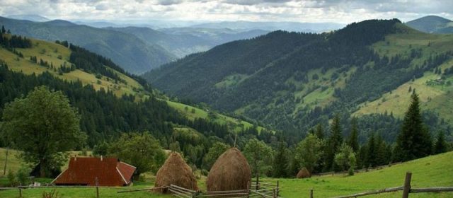


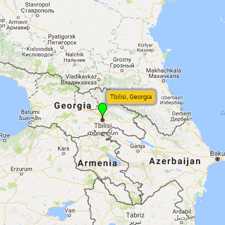
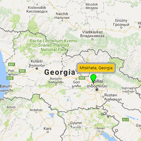
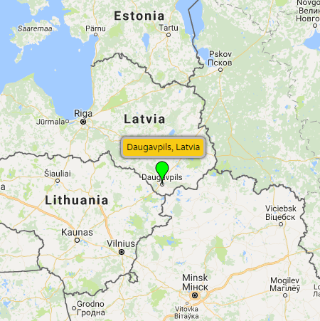
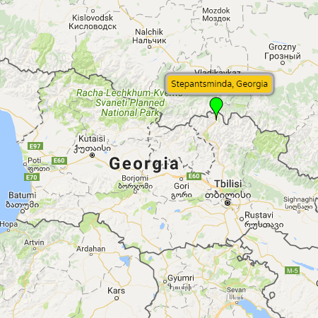
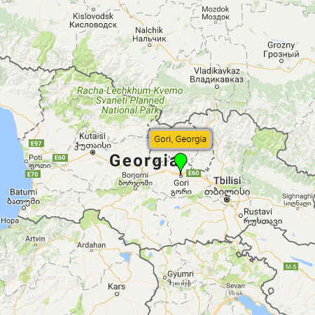
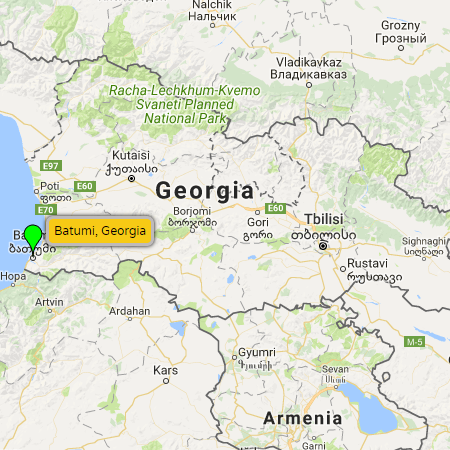
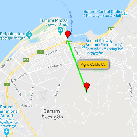
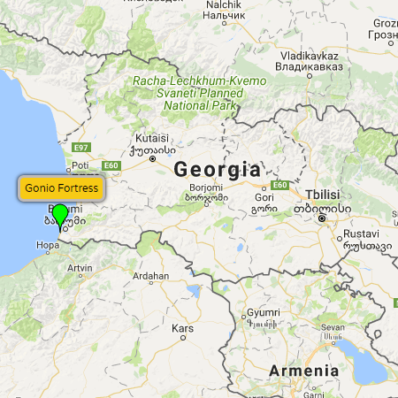
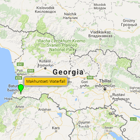
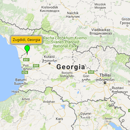
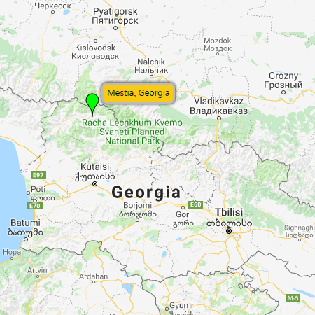
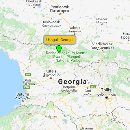
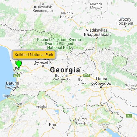
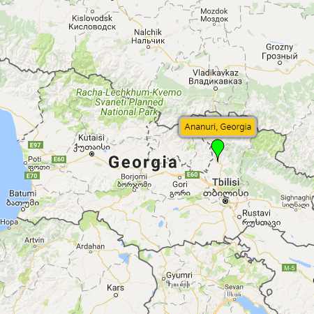
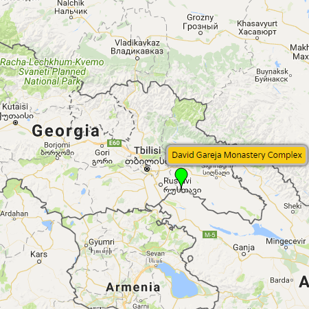
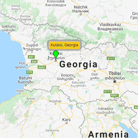
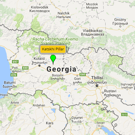
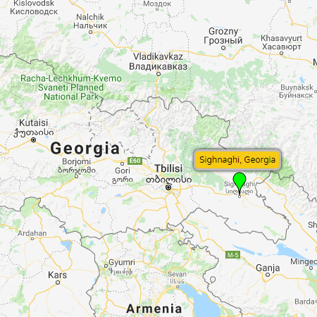
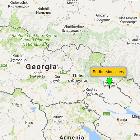
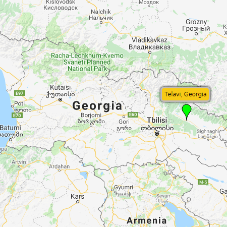
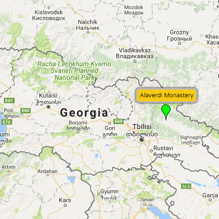
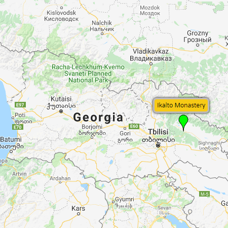
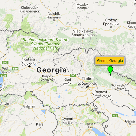
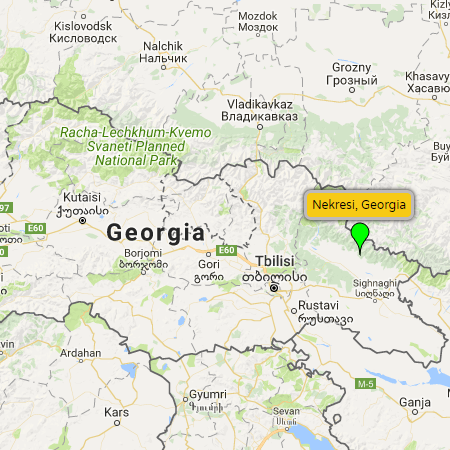
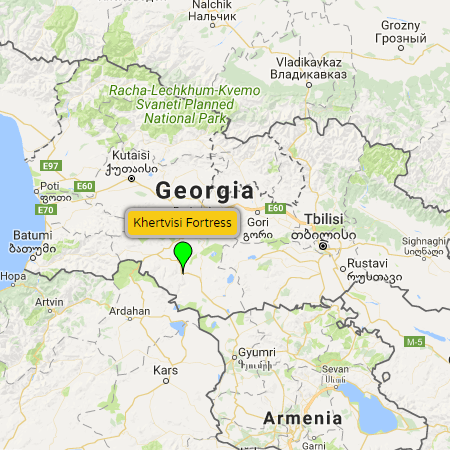
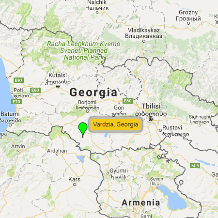
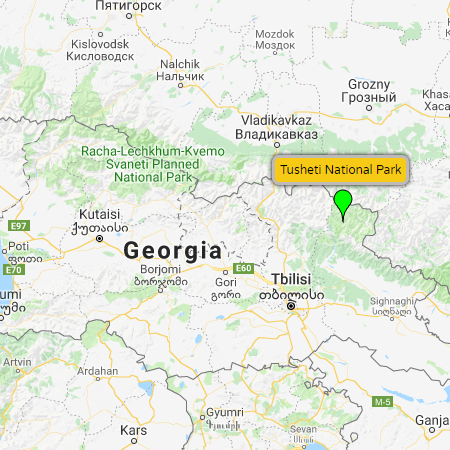
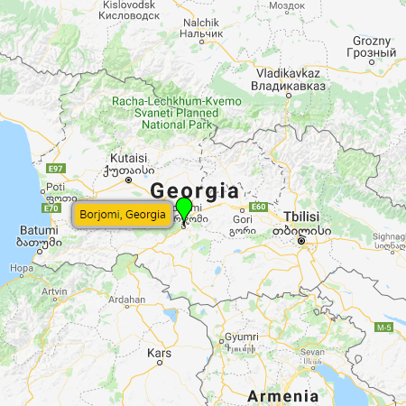
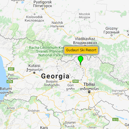