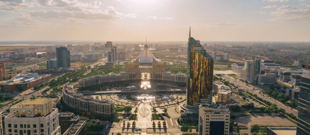
 Nur-Sultan (Astana) - Situated on the banks of the Ishim River in the northern part of of Kazakhstan, the nation's capital and second largest city (after Almaty), was named Nur-Sultan in March 2019 (in honor of departing Kazakh president Nursultan Nazarbayev). Formerly known as Astana (between 1998 and 2019), the planned city (designed from the master plan of Japanese architect Kisho Kurokawa), has rapidly grown into one of Central Asia's most modern cities. The seat of the national government, it is home to Kazakhstan's Parliament House, Supreme Court, the Ak Orda Presidential Palace, as well as various other government departments and agencies. Its impressive skyline exhibits an eclectic mix of architectural styles including many futuristic buildings and skyscrapers. Luring the best and brightest talent from around Kazakhstan, the dynamic young city has an air of aspiration and vibrancy. Nur-Sultan (Astana) - Situated on the banks of the Ishim River in the northern part of of Kazakhstan, the nation's capital and second largest city (after Almaty), was named Nur-Sultan in March 2019 (in honor of departing Kazakh president Nursultan Nazarbayev). Formerly known as Astana (between 1998 and 2019), the planned city (designed from the master plan of Japanese architect Kisho Kurokawa), has rapidly grown into one of Central Asia's most modern cities. The seat of the national government, it is home to Kazakhstan's Parliament House, Supreme Court, the Ak Orda Presidential Palace, as well as various other government departments and agencies. Its impressive skyline exhibits an eclectic mix of architectural styles including many futuristic buildings and skyscrapers. Luring the best and brightest talent from around Kazakhstan, the dynamic young city has an air of aspiration and vibrancy.
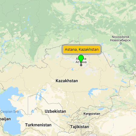
Maps: pop-up map, Google, Bing, Yandex
Resources: Nur-Sultan city council (official website), Nur-Sultan (Wikipedia)
Below are a few of Nur-Sultan's most popular tourist attractions...
- Baiterek Tower (Bayterek Kulesi) - photo - A 97 meter (318 ft) high tower standing in the center of the capital. The main symbol of Nur-Sultan, locals have nicknamed the building “Chupa Chups” since it resembles a giant lollipop. Baiterek Tower offers great views of the city below, plus an art gallery, a small aquarium and a restaurant. In the center of the top sphere, the former President Nursultan Nazarbayev made a golden palm print where visitors may put their own hands.
Map: Google map
- Singing Fountain - photo - A charming fountain near Baiterek Tower that features an impressive light show with dancing water choreographed to classical music.
Map: Google map
- Palace of Peace and Reconciliation - photo - A Norman Foster designed building that serves as a congress hall, hosting national and international summits. Consisting of a 62 meter (203 ft) high pyramid that sits on a 15 meter (49 ft) high block, it appears that just the pyramid sits above ground, even though its just the landscaping of the surrounding park that rises up to cover the lover level. The Palace of Peace and Reconciliation offers great views of the city, two art galleries, an archaeological and ethnographic museum, opera hall, and a cafe.
Map: Google map
- Kazakh Eli Monument - photo - A 100 meter (328 ft) tall monument situated next to the Palace of Peace and Reconciliation (Pyramid), in the center of the Independence Square. Kazakh Eli (which literally means "Land of Kazakhs"), is made from white marble and has a mythical golden bird Samryk on the top.
Map: Google map
- National Museum of the Republic of Kazakhstan - photo - Situated next to the Palace of Independence, the national museum has been in its spacious new location since 2014. Modern, interactive exhibits (in English, Russian and Kazakh languages) are on three levels including: an Astana hall, golden hall, ethnographic exhibition (with comparison of Native Americans to Kazakhs), Iron Age hall, contemporary arts hall, and much more. Highlights include a huge main entrance with a golden eagle that flaps its wings at certain times of the day, and an animated diorama of the planned city of Nur-Sultan that emerges out of the ground floor on the hour. The golden hall (additional charge), displays a model of a golden man costume along with a range of other beautiful golden objects found throughout Kazakhstan. The museum is open every day except for Mondays, from 10am until 8pm.
Map: Google map
Website: kazmuseum.com (official website)
- Hazrat Sultan Mosque - photo - Completed in 2012, it's the largest mosque in Kazakhstan and the second largest in Central Asia. Located next to the National Museum of Kazakhstan, the expansive, calming space can accommodate up to 10,000 worshipers.
Map: Google map
- Nur Astana Mosque - photo - Completed in 2008, its the second largest mosque in Kazakhstan and the third largest in Central Asia. The 40 meter (131 ft) height symbolizes the age of the Prophet Muhammad of when he received the revelations, and the height of the minarets are 63 meters (207 ft), the age Muhammad was when he died.
Map: Google map
- Khan Shatyr Entertainment Center - photo - A shopping and entertainment destination in the center of Astana, the impressive tent-like structure was designed by English architect Norman Foster (same architect who designed the Palace of Peace and Reconciliation). Standing 150 meters (492 ft) high and covering 14 hectares (35 acres), the entire complex of Khan Shatyr houses a shopping plaza, plus a variety of year-round entertainment venues including: a cinema, an amusement park, mini-golf, and an indoor beach resort.
Map: Google map
Website: KhanShatyr.com (official website)
- Atameken Map of Kazakhstan - photo - A 1.7 hectare (4.2 acre) exhibit featuring more than 200 miniature models of Kazakh historical monuments. Visitors can learn about the architectural landscape of Astana, Almaty, and regions throughout Kazakhstan. Guided excursions are available in Kazakh, Russian and English languages (for an extra fee).
Map: Google map
Website: AtamekenMap.kz (official website)
- Lovers Park - photo - Popular with the capital's young couples, Lovers Park stands opposite the Khan Shatyr and at the start of the 2 km long Nurzhol Boulevard. From here visitors can get an interesting view on some of Nur-Sultan’s futuristic buildings.
Map: Google map
- Otan Korgaushylar Monument - photo - The main war memorial in Nur-Sultan, the monument is situated in Defenders of the Fatherland Square. The central part of Otan Korgaushylar is a huge stella with a sculpture of a lady holding a bowl (bowl of milk is meant to symbolize peace and prosperity). On either side of the main sculpture are two curved walls with reliefs. The wall on the left has reliefs of Soviet soldiers, while the wall on the right is a relief of ancient Kazakh warriors. In front of the main monument is an eternal flame.
Map: Google map
- Alzhir Memorial - photo - Situated in the town of Akmol, roughly 32 km (20 miles) from the center of Nur-Sultan, is the site of a a former gulag established by Joseph Stalin. Named the “Akmola Labor Camp for the Wives of the Betrayers of the Homeland,” more commonly known by its Russian acronym of ALZHIR, the camp imprisoned women and children whose only crime was to be related to a man who had been denounced by the state.
Today, the Kazakh government has turned the site into a poignant memorial and museum complex dedicated to victims of repression. A historic rail transport, reconstructed guard tower, and multiple sculptures surround the uniquely designed museum, which contains numerous relics and related stories that recount the painful details of prison life.
Map: Google map
Website: Museum-Alzhir.kz (official website)
|
Almaty - Situated in the southeast corner of the nation, just to the north of the snow-capped Trans-Ili Alatau (Zailiysky Alatau) Mountains and neighboring Kyrgyzstan, is Kazakhstan's largest and most cosmopolitan city. Former capital of Kazakhstan during the Soviet era (known as Alma-Ata), Almaty is still the nation's center of commerce, home to the country's stock exchange and largest banks. Thought to be the birthplace of the domestic apple (the Turkic name for apple is Alma and Ata means forefather), Almaty is also considered the intellectual heart of Kazakhstan thanks to its location along the ancient Silk Road and due to its historical role as a terminus for many exiled Russian intellectuals.
With respect to the city's layout, the Soviet period has had a huge influence on the development of Almaty with plenty of parks, large squares, broad avenues, socialist architecture and huge memorials. Almaty is a pleasant green city, with expensive suburban neighborhoods, many western-style cafes and restaurants, and a vibrant nightlife.
Visit our Almaty travel itinerary.
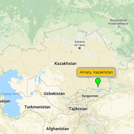
Maps: pop-up map, Google, Bing, Yandex
Resources: Almaty (Wikipedia) |
Home Club - Situated roughly 30 km (19 miles) east of Almaty city center, is a year-round recreational center in a picturesque area of the Trans-Ili Alatau (Zailiysky Alatau) foothills. Home Club offers a secure fenced territory complete with comfortable chalet-style cottages, a lake, swimming pool, walking paths, fountains, mini-zoo, children's play area, and restaurant.
Map: Google map
Website: Home-Club.kz (official website) |
Medeu - Tucked in a sheltered mountain valley less than 10 km southeast of Almaty city limits, is one of the world's highest Olympic-sized speed skating ovals and bandy rinks. Sitting at sits 1691 meters (5548 ft) above sea level, the 10,500 m² (113,000 ft²) of sheet of ice has been home to over 100 speed skating world records since it was first opened in 1951. Today its an all-season recreation center. In the wintertime there is public skating (skate rentals available), while in the summertime there is a large mountain-water swimming pool just below the ice rink, as well as trailheads for a number of good hikes up into the the Trans-Ili Alatau (Zailiysky Alatau) Mountains (originating from the Medeu main bus stop).
Map: Google map
Website: Medeu (Wikipedia) |
Shymbulak Ski Resort - Situated 25 km (16 miles) southeast of Almaty (along the Medeu road), is Central Asia's largest and most modern ski resort. High in the Medeu Valley of the Trans-Ili Alatau (Zailiysky Alatau) Mountains, the elevations of Shymbulak's ski slopes range from 2,260 meters (7,415 ft) to 3,163 meters (10,377 ft) above sea level, giving it nearly 1000 meters (roughly 3000 ft) of vertical drop. There are six lifts and 20 km (12.4 miles) of ski runs. The average snow base ranges between 1.5 and 1.8 meters (60 and 70 inches). Shymbulak Ski Resort is also blessed with a mild climate, large quantity of sunny days, and a long ski season that spans from November until May (prime conditions between late December and early March).
Combine these favorable on-hill attributes with the resort's close vicinity to Almaty and the Almaty International Airport (just 30 km away), an ample availability of hotels, restaurants, and cafes (including a hillside hotel), and its little wonder Shymbulak Ski Resort has gained a reputation as a world-class ski destination.
Visitors can reach the ski resort by taking the Gondola from Meadeu - the world’s third longest Gondola spanning a distance of 4.5 km (2.8 miles).
Map: Google map
Website: Shymbulak.com (official website) |
Tabagan Ski Resort - A smaller, family friendly ski hill roughly 17 km (10.5 miles) east of Almaty. Tabagan offers 37 km (23 miles) of gentle ski slopes (great for the kids), serviced by one two-seat chairlift and several rope tow lifts. Elevation isn't anywhere near Shymbulak - Tabagan only reaches a max elevation of 1,650 meters (5,413 ft) - so snow conditions aren't as long or consistent, but the prices are more affordable than a day at the big ski resort. Tabagan also offers night skiing, a toboggan slide, ice skating rink, hotel rooms and chalets for rent, a swimming pool and sauna, restaurant, and ski and snowboard rentals.
Map: Google map
Website: Tabagan.kz (official website) |
Ile-Alatau National Park - Situated just south of Almaty, on the northern slope of the Trans-Ili Alatau (Zailiysky Alatau) Mountains, is an expansive 2,000 km² (772 mile²) national park that was founded in 1996. The terrain includes woodlands, alpine meadows, glaciers and glacial lakes, which are home to unique flora (including wild varieties of apples and apricots), plus an estimated 300 species of birds and animals (including the elusive Snow Leopard, Central Asian Lynx, Tian Shan Brown Bear, Siberian Ibex, Bearded Vulture and Golden Eagle).
Thanks to its close proximity to Almaty, Ile-Alatau National Park is a great place to do some lovely one-day hikes and treks. The park also offers a variety of great multi-day hikes, though planning for such treks is paramount. Not only can the high alpine terrain be unforgiving, but some of the routes approach the Kyrgyzstan border, which require special permits issued by the Migration Police (OVIR) if you'd like to hike these trails.
Map: Google map
Website: Ile-Alatau National Park (Wikipedia) |
Big Almaty Lake - Situated in Ile-Alatau National Park, only about 15 km (9 miles) south of Almaty, is a scenic mountain lake that functions as the city's main water reservoir. Once open to the public, the lake is now off-limits in order to prevent possible contamination. And though the Big Almaty Lake is also home to some interesting hikes to nearby peaks and glaciers, permits must be obtained from Migration Police (OVIR) to hike in the area. Therefore, its advised to choose other great Ili-Alatau mountain hikes near Almaty that can be done without a permit.
Map: Google map
Website: Big Almaty Lake (Wikipedia) |
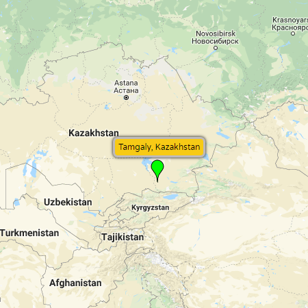
Tambaly (Tamgaly) Petroglyphs - Situated roughly 160 km (100 miles) northwest of Almaty, is a World Heritage-listed historical site with ancient rock etchings dating back to the Bronze Age (though there are some engravings from Medieval times intermixed). Not to be mistaken with Buddhist rock carvings at Tamgaly-Tas (see below), the 5000-plus carvings at Tambaly (meaning “painted” or “marked place”), were predominately the works of much older nomadic peoples who gathered at this ritual site some 3000 years ago.
Visitors will be treated to ancient images of: sun gods, warriors, married couples and pregnant women, plus multi-figured arrangements of hunting scenes and scenes of animal sacrifice. And in addition to the petroglyphs, numerous ancient grave sites are also found at Tambaly.
Maps: pop-up map, Google, Bing, Yandex
Websites: Tanbaly.kz (official website), Petroglyphs of Tanbaly (UNESCO World Heritage List), Tambaly (Wikipedia) |
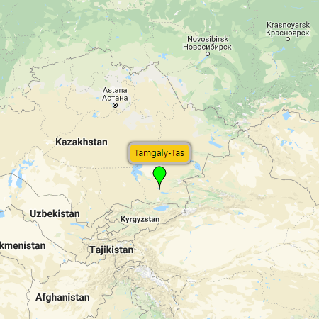
Tamgaly-Tas - Situated roughly 106 km (66 miles) north of Almaty, is a an open-air Buddhist sanctuary on the Ili River featuring rock carvings of Buddha, important Buddhist teachers, and Buddhist mantras in Sanskrit. Not to be mistaken with the ancient Tambaly Petroglyphs (see above), Tamgaly-Tas (“Written Cliffs”) date back to the 14th to 16th centuries AD, when the location was a sacred Buddhist sanctuary used for prayer and meditation.
Maps: pop-up map, Google, Bing, Yandex
Website: EdgeKz.com (article about mysterious Tamgaly-Tas rock carvings) |
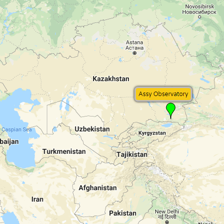
Assy-Turgen Plateau and Observatory - Situated 85 km (53 miles) east of Almaty, is a scenic area worthy of a visit. Used as a pasture by ancient nomadic peoples, and a passage for caravans traveling along the Silk Road, the plateau is now home to an astronomical observatory built by the Fesenkov Astrophysical Institute. Sitting 2,750 meters (9,022 ft) above sea level, the local atmosphere's high transparency plus lack of light pollution and turbulence, creates an ideal environment for stargazing. Though not open to tourists, the futuristic observatory, set on a picturesque natural backdrop, makes Assy-Turgen Plateau a great day-trip destination for a picnic and photography. In addition, there are also several great hiking trails descending to refreshing swimming holes and waterfalls in the Turgen Gorge below.
Maps: pop-up map, Google, Bing, Yandex
Resources: Assy-Turgen Observatory (The Astana Times article), Assy Observatory (YouTube) |
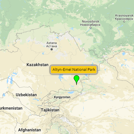
Altyn-Emel National Park - Situated northeast of Almaty, roughly 213 km (132 miles) by road, is an expansive 4,600 km² (1,776 mile²) national park that is home to striking landscapes, fascinating archaeological sites, and rare species of plants and animals. Consisting mostly of dessert, steppe, and rocky terrain lying east of Lake Kapchagai, between the Ili River and Ak-Tau Mountain Range, the parks remoteness shouldn't be a deterrent to visiting this truly unique cultural and natural heritage site. Apart from the visually stunning landscapes (which are reason to go on their own), the parks most notable attractions are as follows...
- Singing Dunes - photo - A beautiful 1.5 km (0.9 mile) long and 120 meter (394 ft) high barkhan (crescent-shaped) dune that makes an unforgettable rumbling sound (like an aircraft engine) when the winds, blowing from the west, start to shift the sand.
- Bes-Shatir Burial Mounds - photo - An Iron Age site comprised of 31 Scythian kurgans (ritual burial mounds), believed to be final resting places of tribal leaders and distinguished warriors. Located in the western part of Altyn-Emel National Park, some of the burial mounds (including one measuring 17meters in height), have turned up bones, weapons and pottery during past archaeological excavations.
- Terekty Petroglyphs - photo - Rock carving in the western part of Altyn-Emel National Park (near the Bes-Shatir Burial Mounds), that depict ibex, Siberian deer (now extinct in these parts), arkhar rams, and human figures riding horses and camels.
- Wildlife - photo - Altyn-Emel National Park is home to 1,800 plant species (including 69 rare species), and over 260 species of animals, including numerous endemic and endangered species. In spring and early autumn visitors have a chance to see (from a distance), rare goitred gazelles, argali (mountain sheep) and Turkmenian kulan (wild ass), as well as Bukhara deer, lynx and Tian Shan brown bear.
Getting to Altyn-Emel National Park is a little more difficult due to the absence of public transportation. The best options are to pre-plan a trip and take a rental car, or simply look for a local Almaty tour agency (online or inquire at Almaty hostels). To enter Altyn Emel National Park you'll need a permit. You can arrange the permit and pay the entrance fee at the Park headquarters in Basshi (see map) or at the branch office in Almaty (see map).
Maps: pop-up map, Google, Bing, Yandex
Resources: Altyn-Emel National Park (Wikipedia), Altyn Emel National Park (YouTube) |
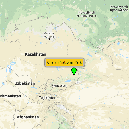
Charyn Canyon National Park - Situated roughly 200 km (124 miles) east of Almaty, towards the Chinese border, is Kazakhstan's version of the Grand Canyon. Though not as big as its American counterpart, the impression it will leave is comparable. The park itself is long and thin, 1,250 km² (483 mile²) in size, protecting the banks of the Charyn River as it cuts through the arid foothills of the Tian Shan Mountains (which lie a short distance to the south). Millions of years of erosion from wind and water have created a canyon that reaches up to 370 meters (1,214 ft) in depth. The result is absolutely stunning landscapes and unique ecosystems that are home to equally rare plants and wildlife. Charyn Canyon National Park's most notable sites and attractions are as follows...
- Valley of Castles - photo - Taking its name from the shapes of the rock formations, Valley of Castles is a small side canyon that branches off from the main Charyn River, with views out to the main canyon. The sedimentary layers create colorful, visually appealing vistas. The approach is by a 10 km (6 mile) road, with parking at the site. There is food and rest areas on site.
- Other Canyons - photo - Apart from the popular Valley of Castles, there are three more less visited canyons inside Charyn National Park. They include: Temirlik Canyon (iron canyon), Uzunbulak Canyon (yellow canyon or moon canyon), and Bestamak Canyon (red canyon).
- Charyn Ash Grove - photo - A remnant stand along the riverbank's canyon floor, of what was once a long forest belt ecosystem of Sogdian Ash trees (Fraxinus sogdiana) that spread across the northern slopes of the Tian Shen Mountains.
- Cemeteries and Burial Mounds - photo - Located 12 km (7 miles) off the Chundzha-Almaty highway is an area of scattered archaeological sites - ancient Scythian kurgans (ritual burial mounds).
- Rafting - photo - For a unique way to see Charyn Canyon (from its very depths), outdoor tour operators offer exhilarating whitewater rafting adventures on the Charyn River.
- Hiking - photo - There is a short 2 to 3 kilometer hike through the Valley of Castles. While this is the only established hiking trail in the park, experienced hikers are able to explore less accessible parts of the park. But be forewarned, terrain is treacherous and there are no facilities beyond the Valley of Castles, so go prepared or go with an experienced guide.
- Wildlife Viewing - photo - Charyn Canyon is home to over 1,500 plant species, 32 mammals, 103 nesting birds, 18 reptiles, and 4 amphibian species (many of which are endangered and/or endemic to the area).
As for accommodations, there are two variants for visitors who wish to spend multiple days exploring the park.
- Camping - photo - If you'd like to pitch a tent in Charyn Canyon, you'll need to pay an additional (modest) entrance fee. There are some cleared and designated camping spaces near the river. *Just remember, if you are visiting in spring or autumn, it can get very cold during the nights.
- Eco Park (see website) - Yurts and wood cabins for rent, which offer a little more protection from the elements than a tent. Eco Park is located roughly 3 km from the Valley of Castles (see map).
Maps: pop-up map, Google, Bing, Yandex
Resources: Charyn.kz (official park website), Charyn National Park (Wikipedia) |
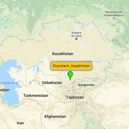
Shymkent - Situated in southern Kazakhstan, only about 120 km (75 miles) north of the Uzbek capital of Tashkent, is the nation's third largest city. Founded as a caravanserai along a Silk Road trade route, the present-day city of Shymkent still retains vestiges of a busy trade center. Today visitors will find lively bazaars hawking cheap Chinese products, as well as those selling fresh produce, meat, dried fruits and street food. And while Shymkent has a small-town vibe, its worthy of a visit - a better representation of a traditional Kazakh Steppe city than its larger counterparts of Almaty and Nur-Sultan. The following is a small list of popular Shymkent attractions...
- Independence Park - photo - Site of the Old City of Shymkent, near the ruins of the fortification, is one of the most popular parks in the city. Independence Park was inaugurated in October 2011 to celebrate the 20th anniversary of the independence of Kazakhstan. Following along the central path is a line of 21 granite monuments, each engraved with the major events from prior years in the nation’s history. The centerpiece, Altyn Shanyrak, honors the unity of the people of Kazakhstan. The monument has 137 steel pillars (representing the 137 nations cohabiting in the country), supporting a shanyrak (circular opening of the top of the yurt). Independence Park is connected to Ordabasy Square via a 104 meter-long bridge, symbolizing the transition from the historical past of the city to its contemporary history. At the top of the stairs, the nation's flag floats in the sky, its map and declaration of independence are engraved in granite, while seven huge columns represent the courage and the combativeness of the Kazakh people. And below sits a musical fountain, which displays an illuminated show in the summer months, every evening between 8pm and 11:30pm.
Map: Google - Ordabasy Square - photo - Square that marks the eastern border of the Old City, where fortified gates and a nearby bazaar were once located. Today, Ordabasy Square is the sight of a 24 meter (79 ft) granite, three-sided obelisk topped by an 8 meter (26 ft) statue of Jer Ana (mother of the land in Kazakh). Symbolizing the unity of the Kazakh people, the monument pays tribute to the meeting of Mount Ordabasy in 1726, when three famous clan leaders (Tole bi, Kazybek bi, and Aiteke bi) decided to join forces to repel an enemy invasion. All three sides of the obelisk are adorned with quotes from the three leaders, advocating the union of the people. In addition, the three streets that converge on Ordabasy Square are also named in honor of these three key figures. The adjacent Koshkar Ata River contains fountains and a bridge that connects the square with Independence Park.
- Koshkar Ata River - photo - A peaceful green space that runs for several kilometers between the river spring and Ordabasy Square. Locals come to the embankment to stroll, pray, bathe and fill their water bottles - for the spring water is believed to have healing properties.
- Abay Park - photo - Park with war memorials, most notably Alleya Slavy (Alley of Glory), which commemorates the 140,000 plus people from the southern Shymkent region who lost their lives fighting for the Soviet Union in the Great Patriotic War. Two tall concrete pillars lean on each other above an eternal flame, while the Alley of Glory is lined with plaques bearing the names of those who lost their lives. There is also a more modest memorial honoring the Kazakh servicemen who perished in the Afghan conflict, plus monuments such as tanks and other military hardware on display.
Map: Google - Museum of Modern Arts - photo - Located close to the north entrance of Abay Park, the Museum of Modern Arts in Shymkent houses a colorful collection of contemporary art from South Kazakhstan artists.
- Museum of Victims of Political Repression - photo - Opposite Abay Park is a small museum dedicated to the memory of victims of political oppression during the first half of the 20th century. The main room houses an unsettling statue that represents captivity, pain and death, surrounded by a picture of Stalin and barbed wire. Surrounding the monument are pictures of victims, sometimes with their stories. Another room, located on the second floor, bears the names of 2,500 people killed in South Kazakhstan - their names engraved on large marble slabs.
Map: Google - Tulip Fountain - photo - Located in the city center, standing at a height of 10 meters (33 ft), is the tallest fountain in Shymkent. A huge red tulip with green leaves, the fountain gives off a cooling mist, making it a favorite destination of locals during hot summer days. Apart from tulips in the springtime, the surrounding square is decorated with seasonal flowers throughout the growing season - another appealing attribute of the spot.
- Regional Museum of Southern Kazakhstan - photo - Situated on the northern outskirts of Shymkent is a relatively new, regional museum with a variety of exhibits featuring local geology, archaeological finds, ethnography, and more contemporary South Kazakhstan history.
- Arbat - photo - Located next to Techno Park, Arbat is a fun, tree-lined pedestrian road with restaurants, cafes, local street musicians, and light installations that create a special ambiance in the evenings.
- Ayna Bazaar - photo - Situated in a micro-region a bit outside of the center, Ayna Bazaar offers inexpensive food products (fruits, vegetables, spices, meat and dairy), plus an abundance of cheap Chinese goods (clothes, electronics, and household goods).
Map: Google - Dendropark - photo - Large forested park covering 120 hectares (296 acres) that includes more than 600 varieties of trees and plants. A protected natural area of local importance (as the spring of Koshkar Ata River), at the heart of the Dendropark is a picturesque lake with geese, ducks and swans, where you can rent pedal boats. A popular photo-stop for newlyweds, its a pleasant place to relax and take a stroll - a nice respite from the hustle of the city. *There is a small entrance fee to enter the park.
Map: Google
Maps: pop-up map, Google, Bing, Yandex
Resources: Akimat (gov't) of Shymkent (official website), Shymkent (Wikipedia), ShymkentSweetTexas.com |
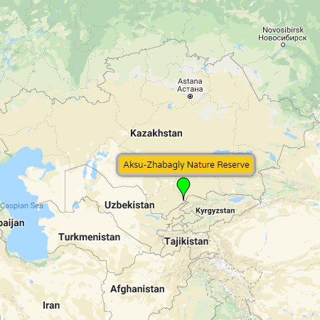
Aksu-Zhabagly Nature Reserve - Situated in southern Kazakhstan along the northwestern extension of the Tian Shan mountain range, bordering Uzbekistan to the south and Kyrgyzstan to the east, is the nation's oldest nature reserve (established in 1926). Covering an area of 1,319 km² (509 miles²), Aksu-Zhabagly Nature Reserve offers stunningly diverse landscapes, from semi-deserts at 1,100 meters (3,609 ft) above sea level, to snow-capped peaks at elevations reaching 4,236 meters (13,898 ft).
Famous for its wild tulips in the spring, Aksu-Zhabagly Nature Reserve offers hiking, horse-back riding, rock climbing, jeep tours, and is a favorite destination of bird watchers. The region is home to many endemic plant species, plus a wide range of wildlife. Some of the more prominent animal species found in the reserve include the the Himalayan Brown Bear, Argali Sheep, Ibex, Snow Leopard, Menzbier's Marmot, and Golden Eagle.
Accessing Aksu-Zhabagly Nature Reserve is accomplished via Zhabagly village - roughly 70 km (43 miles) east of Shymkent. From Shymkent, there are sometimes direct marshrutki (minibuses) from Aina Bazaar bus station to Zhabagly. If they're not running, look for marshutki going to Tulkibas or Turarkent (also called Turar Ruskylov). From these villages, reasonably priced taxis will shuttle you the short distance (10 km or so), to Zhabagly. For more information about arranging tours, excursions and accommodations, visit the website of the Aksu-Zhabagly Nature Reserve visitor center in Zhabagly (see map).
Maps: pop-up map, Google, Bing, Yandex
Resources: Aksu-Zhabagly Nature Reserve (Wikipedia), Aksu-Zhabagly Reserve (YouTube) |
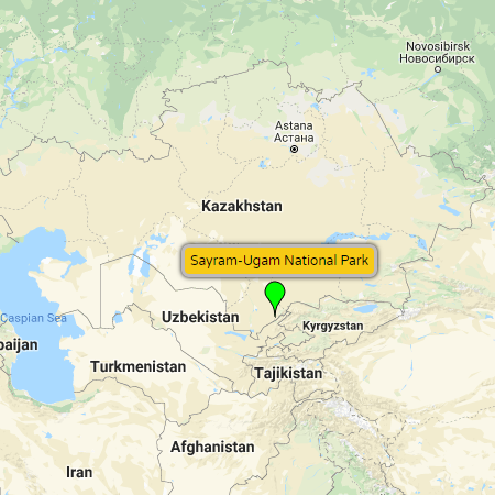
Sayram-Ugam National Park - Situated roughly 30 km (19 miles) southeast of Shymkent, is a Kazakh national park running along the northwestern end of the Tian Shan mountain range. Bordering Uzbekistan, as well as the better known Aksu-Zhabagly Nature Reserve to the northeast, Sayram-Ugam National Park is the more affordable destination between the two. The park incorporates 1,490 km² (575 miles²) of protected area ranging from wild gorges and canyons, to mountain lakes and rivers, to high-elevation peaks and glaciers. The area is estimated to have in excess of 1,600 species of flora, including many wild varieties of familiar fruit and nut trees: apple, pear, walnut, plum, and grape. Noteworthy animal species include the Red fox, Eurasian wolf, Golden jackal, Ibex, Wild boar, and Roe deer.
For a small entrance fee, Sayram-Ugam National Park is accessible for hiking and horseback riding. If you're not into camping, prearranged accommodations (with the help of a guide or tour operator) include: a hotel, non-serviced yurts, or homestays in the villages of Kaskasu, Dikankol and Tonkeris, as well as in the park's staging area - the town of Lenger (see map).
Maps: pop-up map, Google, Bing, Yandex
Resources: Sayram-Ugam National Park (Wikipedia) |
Mausoleum of Khoja Ahmed Yasawi - Located in the southern Kazakh city of Turkistan, roughly 163 km (101 miles) northwest of Shymkent, is a 14th century mausoleum built on the 12th century burial spot of Sufi mystic Khoja Ahmed Yasawi. Commissioned in 1389 by Timur (ruler of the expansive Timurid Empire), construction was never completed - halted upon Timur's death in 1405. Despite its incomplete state, it remains one of the largest and best-preserved examples of Timurid construction.
Built of fired brick, the structure's rectangular plan measures 45.8 × 62.7 m (150.3 × 205.7 ft), and stands 38.7 m (127.0 ft) high. It has 35 rooms including a dining room, meeting rooms, a library, and a mosque (with geometric and floral ornaments on its walls). A conic-spherical dome, the largest in Central Asia, is decorated with hexagonal green glazed tiles with gold patterns. The innovative spatial arrangements, vaults, domes, and decoration of the mausoleum were prototypes that served as models for other major buildings of the period, in particular in Samarkand. The Mausoleum of Khoja Ahmed Yasawi has been protected as a national monument, and was inducted as a UNESCO World Heritage site in 2003.
Maps: Google, Bing, Yandex
Resources: Mausoleum of Khoja Ahmed Yasawi (UNESCO World Heritage List), Mausoleum of Khoja Ahmed Yasawi (Wikipedia), Mausoleum of Khoja Ahmed Yasawi (YouTube) |
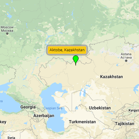
Aktobe - Situated at the crossroads between Europe and Asia (technically in Europe), Kazakhstan's fourth largest city lies just south of the southern end of the Ural Mountains. An oil and gas town and major transport hub, it doesn't exactly fall on the top “must-see” destinations for tourists exploring Central Asia. Nevertheless, Aktobe has its share of local tourist sites and entertainment venues - enough to keep most visitors amused during their visit. Apart from run-of-the-mill parks and monuments, the regional capital is home to the Aktobe Planetarium, FC Aktobe football club, the beautiful Nurgasyr Regional Central Mosque (see map), plus several spring celebrations - “Fountain Splashes” on May 1 (opening of the summer season), and “City Day” on May 28.
Maps: pop-up map, Google, Bing, Yandex
Resources: Aktobe (Wikipedia) |
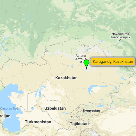
Karaganda (Karagandy) - Situated in the heart of the Kazakh Steppe, only about 212 km (132 miles) southeast of the capital of Nur-Sultan, is the nation's fifth largest city. A coal mining town during Soviet times, made infamous for Stalin-era gulags that were created to house forced laborers who worked the mines, the city's rather dark history also gave rise to a rather diverse ethnic variance in the population. In addition to a Kazakh and Russian mix, there is also Korean heritage, a concentration of ethnic Poles, and up until the dissolution of the Soviet Union, there were many ethnic Germans (Volga Germans), who were deported to Karaganda when the Nazis invaded in 1941. And on a more positive light, Karaganda is also associated with the Soviet Space program. It was here that Cosmonauts came to train, thus one will see monuments to the greats (including Yuri Gagarin), at various locations around the city.
Despite its infamous history, Karaganda today is a pleasant city to visit. The center has plenty nice restaurants, cafes, parks and broad tree-lined streets that are brightly illuminated after dark. The following are a few of the notable things to do when visiting Karaganda...
- Central Park - photo - A large public park surrounding a lake in the center of Karaganda. Attractions include a small amusement park, beach, and ice skating in the winter. There's also a 5 km loop of miniature diesel powered railway (originally intended as a training track for young pioneers), that will take kids and adults for a ride around the perimeter of the park in the summertime. (see map)
Map: Google - Stroll the City Center - photo - For fans of Soviet nostalgia, the center of Karaganda has a host of interesting monuments and murals do discover. From the Gagarin Monument on Shalkyma Square (see map), to the colorful murals of coal miners and cosmonauts (lots around Independence Square - see map), to statues of Lenin and other Soviet luminaries (check out the Lenin statue at the Palace of Children and Youth - see map), to the monument of Soviet-Korean rock legend Viktor Tsoi (near Shakhter football stadium - see map). And while wondering around, don't hesitate to stop into one of many cafes and bars for an inexpensive snack and a drink.
- Karaganda Regional Museum - photo - Museum exhibiting the history and anthropology of the Karaganda region. Starts with archaeological findings in the area that detail the story of the nomadic tribes and warriors that roamed the Steppes on horseback. Progresses through different rooms covering new time periods and themes. There's a large focus on Soviet repression, including the Kazakh Famine of 1932-33, the gulags, and the Baikonur space program. It ends with a room about detailing the achievements of former president Nursultan Nazarbayev.
Map: Google map
Website: Karaganda Regional Museum - Karaganda Ecological Museum - photo - A small museum (with a focus more towards schoolchildren), that covers a range of ecological issues from the space debris around Karaganda, to the effects of the nuclear tests around Semipalatinsk, to the plight of the critically endangered Saiga antelope.
Map: Google map
Website: Karaganda Ecological Museum - KarLag Museum - photo - Located in the village of Dolinka, 40 km (25 miles) southwest of Karaganda, is the administrative building of the former KarLag forced labor camp. Turned into a museum, it tells an educational and evocative story of one of the Soviet Union's biggest gulags. From 1931 to 1960, over a million political prisoners were sent here, many of whom perished under cruel, tortuous conditions.
To get to the KarLag museum, take any bus from the Karaganda Central Bus Station (see map) that's going to Shakthinsk or Shachta 2 (Шахта 2). You shouldn't have to wait more than 20 minutes between buses, and the trip doesn't take more than an hour. Get off at the Vtoroy Shakht stop. From here you can take a taxi or walk about 30 minutes to the museum.
Map: Google map
Resources: Karlag (Wikipedia), KarlagMuseum.kz
Maps: pop-up map, Google, Bing, Yandex
Resources: Karaganda (Wikipedia) |
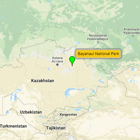
Bayanaul National Park - Situated in the Pavlodar Region of northeastern Kazakhstan, a 438 km (272 mile) drive east of Nur-Sultan (through the industrial city of Ekibastuz), or a 260 km (161 mile) drive northeast from Karaganda, is the country's first national park. Covering an area of 684 km² (264 mile²), Bayanaul National Park was founded in 1985 to help preserve the natural ecosystem of the Bayanaul Mountain Range - a geological formation that took shape during the Paleozoic Era (hundreds of millions of years ago). A virtual oasis in the middle of the steppe, the park is home to relatively low-lying mountains - reaching 400 to 1,027 meters (1,312 to 3,369 ft) above sea level, four relatively large fresh water lakes (amongst many smaller ones), rocky mountain outcrops, four ecological regions (forest, forest-steppe, steppe and meadow), and a host of unique plants and animals. Bayanaul National Park's most popular activities and attractions are as follows...- Animal and Bird Watching - photo - The park is home to roughly 50 species of birds including cranes, swans, herons, bustards, eagles, kestrels and kites. Around 40 species of mammals inhabit Bayanaul National Park, including argali (mountain sheep), Siberian roe deer, European badgers and squirrels.
- Rock Climbing - photo - Popular with rock climbers, the park’s three mountains - Akbet (the highest point in Bayanaul), Naizatas ("stone spear" translated from Kazakh), and Bold Peak - offer technical climbing and bouldering opportunities across varying scales of difficulty.
- Rock Formations and Caves - photo - Millions of years of water and wind erosion have created rock formations with fascinating shapes. Visitors from all over come to view and photograph these natural sculptures. Amongst the most famous is Baba-Yaga stone, resembling an old lady’s head. Others resemble animals and various objects, including one of the male sex organ that has been euphemistically named “Masculine Dignity”. There are also several mystical caves. One that may grant you a wish. Another that is said to help infertile parents conceive a child.
- Water Recreation - photo - Visitors flock to the park’s two biggest lakes to enjoy their refreshing waters. The largest of the two is Sabyndykol Lake. With Bayanaul Village located on its shore, it is known for its soft water, which feels almost soapy to the touch. The smaller Jasybay Lake, located in a hollow between two mountain ridges, boasts a beach lapped by crystal clear waters - perfect for swimming, sailing and boating.
- Fishing - photo - Toraygir Lake (third in size of the four large lakes), is less popular with swimmers due to its less transparent waters, but attracts fishermen for the several different varieties of carp found in the lake. Byrzhankol Lake (the smallest of the four large lakes), is also popular for its carp fishing.
Maps: pop-up map, Google, Bing, Yandex
Resources: Bayanaul National Park (Wikipedia) |